
- left Beaver Kill - elevation 1,560 ft (475 m) - elevation 880 ft (268 m) Discharge 48.56 m³/s Basin area 2,145 km² Country United States of America | - location SW of Grand Gorge - location Hancock - average 1,715 cu ft/s (49 m/s) Length 121 km Source Delaware County, New York Bridges Downsville Bridge | |
 | ||
Mouth West Branch Delaware River | ||
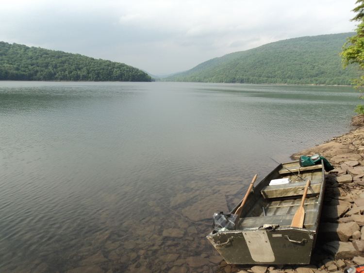
East branch delaware river flyfishing august 2016
The East Branch Delaware River, approximately 75 miles (120 km) long in the U.S. state of New York, is one of two branches, along with the West Branch, that join to form the Delaware River. It flows through a mountainous area on the southwestern edge of the Catskill Park. For a long stretch it serves as the Blue Line, the park's boundary. Much of it is paralleled by state highway NY 30.
Contents
- East branch delaware river flyfishing august 2016
- Map of East Branch Delaware River New York USA
- Nymping up a 20 inch rainbow trout east branch delaware river new york
- CourseEdit
- References
Map of East Branch Delaware River, New York, USA
The river is a popular destination for fly fishing for brown trout. It was impounded just north of Downsville in the mid-20th century to create Pepacton Reservoir, which supplies drinking water to New York City.
In 1881 John Burroughs, a native of the area, published "A Summer Voyage", recounting a solo boat trip down the East Branch from Arkville to Hancock.
Nymping up a 20 inch rainbow trout east branch delaware river new york
CourseEdit
It rises in eastern Delaware County, from a small pond next to a gas station on Route 30 just below the divide with the Hudson watershed southwest of the hamlet of Grand Gorge and flows initially SSW, through the town of Roxbury. Its upper course winds through a narrow valley containing the river and Route 30. At the Middletown town line, it turns more to the south, receiving the Bush Kill, whose tributaries drain the town of Halcott, the only part of Greene County in the Delaware's watershed, from the east just outside Arkville. This confluence also puts the Catskill Park Blue Line in the middle of the channel
Route 30 remains parallel as the East Branch returns to the southwest, flowing through the small village of Margaretville, the first significant settlement along the river, where NY 28 joins Route 30. The two roads remain alongside for the next few miles as the East Branch widens into Pepacton Reservoir. A short distance from the north end of the reservoir, Route 28 leaves Route 30 at the former hamlet of Dunraven, cleared to make room for the reservoir.
Pepacton Reservoir continues, with the Blue Line along its north shore, carrying the river through the towns of Andes and Colchester as its course moves more to the west. Route 30 crosses it midway along its length. The Downsville Dam just north of the village of that name marks the reservoir's southern end. Below the dam and its spillway the river narrows again, to where routes 30 and 206 cross just outside the village.
It continues winding through a wider valley alongside Route 30 to East Branch, where the East Branch's most significant tributary, the Beaver Kill, a world-renowned trout stream that rises in western Ulster County, flows in from the east. Here Route 30 ends and the NY 17 expressway, slowly being converted into Interstate 86, parallels the river, crossing back and forth. At the Hancock town line, the Blue Line turns to follow it south, taking the East Branch out of the Catskill Park. A few miles below that, at the village of Hancock, it turns south and joins the West Branch to create the Delaware's main stem.