
Population 79 (2006) South Australia Tanbar | South Australia Durham South Australia Cameron Corner | |
 | ||
Durham is an outback locality in the Shire of Bulloo, Queensland, Australia. In the 2006 census, Durham had a population of 79 people.
Contents
Map of Durham QLD 4492, Australia
Geography
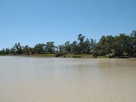
Cooper Creek passes north-south through the centre of the locality.
Three major outback roads pass through Durham:
Attractions
The heritage-listed Burke and Wills Dig Tree is located beside the Bullah Bullah Waterhole at the Nappa Merrie pastoral station (27.6216°S 141.0734°E / -27.6216; 141.0734 (Burke and Wills Dig Tree)).
References
Durham, Queensland Wikipedia(Text) CC BY-SA