
Airport type Public 05/23 2,400 | Location Dunnville, Ontario Elevation AMSL 600 ft / 183 m Elevation 183 m Phone +1 905-774-9262 | |
 | ||
Operator No. 6 RCAF Dunnville Museum 1999 Inc. Address 536 Regional Rd 7, Dunnville, ON N1A 2W2, Canada Similar Haldimand County Hydro Inc, Dunnville Chamber of Comm, Grandview Lodge, Township of Wainfleet, Freedom Oaks Golf Club | ||
Krystal and her brother drive from niagara falls to the dunnville airport
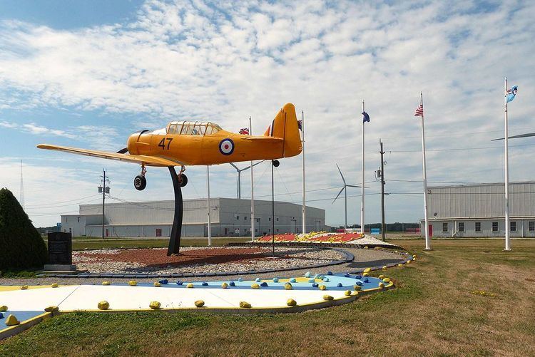
Dunnville Airport, (TC LID: CDU9), was a registered aerodrome located 2 nautical miles (3.7 km; 2.3 mi) south of Dunnville, Ontario, Canada. It was built during World War II as part of the British Commonwealth Air Training Plan and was home to Royal Canadian Air Force No.6 Service Flying Training School. No. 6 SFTS opened on 25 November 1940 and closed on 1 December 1944. There is a museum at the airport commemorating the training school.
Contents
- Krystal and her brother drive from niagara falls to the dunnville airport
- Landing on dunnville airport
- Former tenants
- References
In 2003 the airport was designated a National Historic Civil Engineering Site by the Canadian Society of Civil Engineers.
On 30 May 2013, all flight operations ceased at the airport to make way for industrial wind turbines.
The former airport is privately owned, but the public is welcome at the museum. Located within the village of Port Maitland, it sits on 400+ acres of land. There are five airplane hangars and several buildings dating from the 1940s on the site. There are two public mini-storage buildings, one being large enough to store R.V.s and other large vehicles indoors. The past few seasons of Canada's Worst Driver was filmed here.