
Termini Central
Dulwich Hill Services L1 Dulwich Hill Line | Stations 23 | |
 | ||
Ridership 6.1 million (June 2015) Opened 11 August 1997 (Central-Wentworth Park)
13 August 2000 (Wentworth Park-Lilyfield)
27 March 2014 (Lilyfield-Dulwich Hill) Owner Transport for New South Wales | ||
The Dulwich Hill Line (numbered L1 and also known as the Inner West Light Rail), is a light rail line in Sydney, New South Wales Australia running from Central railway station through the Inner West to Dulwich Hill. The 23-stop, 12.8-kilometre route is the only operational light rail line in Sydney.
Contents
- Background
- Construction
- Extension to Dulwich Hill
- Connection to the CBD and South East Light Rail
- Ownership operation
- Ticketing
- Naming
- Patronage
- Fleet
- Stations
- Central
- Capitol Square
- Paddys Markets
- Exhibition Centre
- Convention
- Pyrmont Bay
- The Star
- John Street Square
- Fish Market
- Wentworth Park
- Glebe
- Jubilee Park
- Rozelle Bay
- Lilyfield
- Leichhardt North
- Hawthorne
- Marion
- Taverners Hill
- Lewisham West
- Waratah Mills
- Arlington
- Dulwich Grove
- Dulwich Hill
- References
Most of the line is built on the path of the former Metropolitan Goods railway line, opening in stages between 1997 and 2014. Operation and maintenance of the line is contracted to the ALTRAC Light Rail consortium by Transport for New South Wales, a statutory authority of the New South Wales Government. Services on the line are operated by Transdev Sydney as a member of ALTRAC Light Rail.
Background
Most of the alignment of the Dulwich Hill Line had its origins as the Metropolitan Goods railway line. From the time when the Sydney Railway Company was formed in 1848, it had been the intention of the company to build a freight terminal at Darling Harbour. To this end, a railway line was constructed between the Sydney Railway Station (the predecessor to Central railway station) and Darling Harbour, which opened on 26 September 1855. This line was extended to Dulwich Hill via Lilyfield in 1922. A short branch from Lilyfield to Rozelle served another freight terminal.
With widespread use as a freight line throughout the early 20th century, the use of containers and the decentralisation of freight terminals in Sydney to places such as Port Botany and Chullora, Darling Harbour traffic was reduced considerably. The port closed and the area was redeveloped in the 1980s.
Construction
Construction and conversion of the first section of line from Central station to Wentworth Park started on 25 January 1996 and took 16 months to complete. The 3.6-kilometre (2.2 mi) line reused the former Darling Harbour goods railway line and the tram loop at Central station originally built for Sydney's former tram network, with a new section of track built along Hay Street to connect the two.
The original route opened for public operation with a limited 09:00 to 17:00 service on 11 August 1997 with three weeks of testing. The official public opening was conducted by State Premier Bob Carr on 31 August 1997.
Buoyed by the success of the original line, a 3.6-kilometre, four stop extension of the route opened on 13 August 2000. This saw the light rail reach Lilyfield, which was then the limit of the closed section of the goods line.
Extension to Dulwich Hill
In 2009 goods traffic on the line between Rozelle and Dulwich Hill ceased and in February 2010 the Keneally Government announced a 5.6-kilometre (3.5 mi) extension of the light rail from Lilyfield to Dulwich Hill.
Work to upgrade the track and remove the overhead wiring began in August 2010. The project received planning approval in February 2011. The extension was originally scheduled to open in 2012, but in September 2011 the newly elected O'Farrell Government announced that it would not open until 2014, and that the cost had risen from $120 million to $176 million. The Greenway walking and cycling path which was to run alongside much of the route was deferred. The new government blamed hasty planning by their predecessor for the delay and cost overruns, and the lack of an active transport masterplan for the deferral of the Greenway.
John Holland Group was announced as the successful tenderer for the infrastructure works on 31 May 2012, covering the design and construction of the nine stations, bridge works, signalling and power supply. The extension opened on 27 March 2014.
Connection to the CBD and South East Light Rail
The line was closed was closed between Central and Convention in January 2017 to allow for construction work at the George and Hay Street intersection as part of the CBD and South East Light Rail project. A further closure will be required to install a junction between the two lines. The connection will be used by trams of the CBD and South East line to access a maintenance facility at Lilyfield.
Ownership & operation
In March 1994 the Sydney Light Rail Company was formed. It was owned by Australian Infrastructure Fund (39%), Utility Trust of Australia (39%) and Legal & General (22%) and was awarded a 30-year concession to operate the light rail system until February 2028 when ownership would pass to the State Government. The service was originally operated by TNT Transit Systems.
In August 1998 Sydney Light Rail's investors formed a joint venture named CGEA Transport Sydney to purchase TNT Transit Systems, the owners of the Sydney Monorail. The shareholders in CGEA Transport Sydney were CGEA Transport (51%), Australian Infrastructure Fund (19%), Utility Trust of Australia (19%) and Legal & General (11%). Following this purchase, operations of both the light rail and the monorail became subsidiaries of Metro Transport Sydney, which then contracted out the day-to-day operations to Transdev. In March 2012, Metro Transport Sydney was purchased by the Government of New South Wales.
The line operated without serious incident until 7 October 2013, when two trams derailed within the space of 20 minutes. Sections of track were replaced in September and it is thought the new track damaged the wheels of the trams. All services were suspended and replaced by buses. Services resumed between The Star and Lilyfield on 18 October, and along the full length of the line on 30 October.
In February 2014, three consortia were short listed to build and operate the CBD and South East Light Rail. The contract also included the right to the operate the Dulwich Hill Line. The three short listed operators were Keolis (iLinQ consortium), Serco (SydneyConnect consortium) and Transdev (Connecting Sydney consortium). In December 2014, the Connecting Sydney consortium (which was renamed ALTRAC Light Rail) was awarded the contract, meaning Transdev retains the right to operate the Dulwich Hill Line. The new contract began in July 2015 and runs until 2034.
Ticketing
When it first opened, the line used its own paper-based ticketing system that was separate from the semi-integrated ticketing systems used by the government owned operators. The light rail operated on a proof-of-payment system, with ticket vending machines provided at all stops. By the time the Lilyfield extension opened, the machines had been switched off and replaced with conductors on the trams. Paper tickets were available in single or return with fares based on two zones. Other products available included Flat fare day and weekly tickets, some of which also included travel on the monorail prior to that system's closure.
Several tickets were recognised on the light rail but are not sold on trams. A "TramLink" ticket which allowed travel on Greater Sydney train services and the light rail was available from railway stations. From 27 June 2011, all MyMultis, the Pensioner Excursion Ticket and Family Funday Sunday were also recognised. This improved integration with the broader Sydney ticketing system led to a 30% to 40% increase in patronage on the line in the first months after introduction. In 2012-13 these products comprised just over half of all tickets used on tram services.
The smartcard-based Opal ticketing system was introduced to the line on 1 December 2014. Patronage increased in the months following the introduction of Opal. Most paper tickets sold or recognised on light rail services were discontinued on 1 January 2016. The only tickets still available were single and return tickets. These last remaining tickets were replaced by Opal-based single trip tickets on 1 August of that year.
Naming
As the original line of Sydney's light rail network, the Dulwich Hill Line lacked special branding and was simply known as the Sydney Light Rail - and later Metro Light Rail after the system was re-branded. Following the purchase of Metro Transport Sydney by the NSW Government and the announcement of the CBD and South East Light Rail, the line was named Inner West Light Rail. Since the opening of the 2014 extension to Dulwich Hill, passenger-facing branding of the line has referred to it as the Dulwich Hill Line. The line was given the number L1 as part of a broader program to also number all Sydney Trains and Sydney Ferries routes.
Patronage
A transport plan released by the New South Wales Government in 1998 reported that the line carried an average of 5000 passengers on weekdays. 2.8 million journeys were made in 2009-10, increasing to 4.2 million in 2012-13. The partial integration of the line into the broader Sydney ticketing system was a major driver of the increase. In the 12 months to June 2015, the line carried 6.1 million passengers, compared to 3.9 million passengers in the prior year. The increase in the 2014-15 figure was influenced by the opening of the extension to Dulwich Hill in March 2014, while the 2013-14 figure was affected by the suspension of services for much of October 2013 and closures for maintenance works.
Fleet
The line is served by a fleet of twelve Urbos 3 trams. The first Urbos 3s entered service in July 2014, with the final tram delivered by the end of June 2015.
When the line first opened, a fleet of seven Variotrams were built in Dandenong by Adtranz to operate the services. The last Variotram was withdrawn in May 2015, with all put up for sale by tender. Between the opening of the Dulwich Hill extension in March 2014 and the introduction of the first Urbos 3s, the Variotrams were supplemented by four leased Urbos 2 vehicles.
Stations
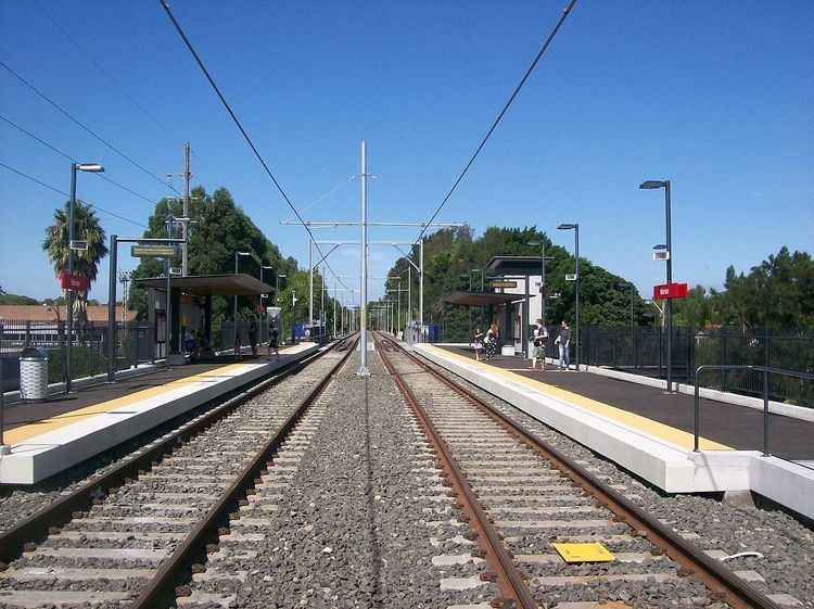
The 23-station route extends for 12.8 kilometres (8.0 mi), including 1.5 kilometres of on-street operation. Apart from Central, Capitol Square and Paddy's Markets, all stops are located on the route of the former railway line. Trams operate between Central and Dulwich Hill from 06:00 to 23:00 from Monday to Thursday, extending to 00:00 on Friday and Saturday. The standard frequencies are every 8 to 10 minutes during weekday peak hours, every 15 minutes at other times on weekdays and every 10 to 15 minutes on weekends (with reduced services before 9 AM). The section between Central and The Star is open 24 hours a day, trams operate overnight on this section every 30 minutes.
Central
Central is the eastern terminus of the line. It serves Central railway station and is located on the first floor, parallel to, but above, Eddy Avenue. The stop connects to the Grand Concourse, Central station's main waiting area and the departure hall for medium and long distance train services.
The stop consists of a single platform on a unidirectional turning loop around Belmore Park. The use of the loop avoids having to terminate the vehicles and the removes the need for the driver to change ends. This loop was not new; it had been used until 1957 as a route on the former Sydney tramway system, but in the opposite direction. The covered area in which the light rail stop is located was previously used as a staff car-park and bus interchange. The stop received an upgrade during January 2017 when the city section of the line was closed for works at the George and Hay Streets intersection.
Capitol Square
Capitol Square is opposite the Capitol Theatre, a large theatre for long-stay, popular shows such as The Lion King. The stop is located on Hay Street, near the intersection with George Street. Hay Street is closed to all other traffic. The CBD and South East Light Rail will run along George Street, creating a tram crossing at the intersection. A connection between the two lines will be created to enable trams from the new line to access a maintenance facility at Lilyfield.
Paddy's Markets
Paddy's Markets (formerly Haymarket) is located in Haymarket (near Sydney's Chinatown) outside the flea market type Paddy's Markets. The name also belonged to a stop on the former Sydney Monorail. The monorail stop was located to the west of the light rail stop and was originally called Powerhouse Museum. It was connected to a multi-storey car park, with a footbridge across Darling Drive and the light rail providing access to the Powerhouse Museum and the suburb of Ultimo. In 2005, both stops were renamed Paddy's Markets in a naming rights deal.
The area to the north of the light rail stop forms part of a major redevelopment of the Darling Harbour precinct. Prior to redevelopment, a public square existed between the stop and the Sydney Entertainment Centre - a former multi-purpose events venue. The redevelopment plans include the demolition of the Entertainment Centre, car park and monorail stop, and the creation of a 'creative quarter' named Darling Square featuring retail outlets, offices and apartments. The public square adjacent to the light rail stop will be replaced with a new square further to the north. A pedestrian boulevard was constructed through the site of the Entertainment Centre, providing improved access from the stop to Darling Harbour. To prepare for the redevelopment, the monorail closed in June 2013 and demolition of the site commenced in December 2014. The Entertainment Centre was replaced by the ICC Sydney Theatre, located near the Exhibition Centre stop.
To the west of the stop, the light rail crosses Darling Drive and joins the former freight railway corridor. The section of the corridor not being used by the light rail has been converted to a pedestrian pathway, dubbed The Goods Line.
Exhibition Centre
Exhibition Centre serves the suburb of Ultimo and the Darling Harbour precinct. The stop is located between two streets - Darling Drive to the east and Pyrmont Street to the west. It is named after the former Sydney Exhibition Centre - a complex for holding expositions and trade fairs that was located on the opposite side of Darling Drive. A replacement facility on the same site - the International Convention Centre Sydney - was completed in 2016. The stop is now adjacent to the ICC's exhibition precinct and the ICC Sydney Theatre. The Ian Thorpe Aquatic and Fitness Centre is located on the opposite side of Pyrmont Street. The Powerhouse Museum is also nearby. The former Sydney Monorail ran parallel to the light rail through the stop.
Convention
Convention is located adjacent to Darling Drive, at the western edge of the Darling Harbour precinct. The stop is named after the former Sydney Convention Centre and its replacement, the International Convention Centre Sydney. There are hotels located on both sides of the stop. The convention precinct of the ICC complex and the Harbourside Shopping Centre are also located adjacent to the stop.
A monorail stop with the same name was located a few metres down Darling Drive towards Central. The monorail closed in June 2013.
Pyrmont Bay
Pyrmont Bay is located underneath an apartment building in Pyrmont. The stop services the north western side of the Darling Harbour precinct. It is close to the Australian National Maritime Museum and the Harbourside Shopping Centre. The nearby Pyrmont Bridge provides access to the city.
The Star
The Star (formerly Star City) is the primary means of public transport serving The Star casino and entertainment complex, in Pyrmont. The stop is located underneath the casino alongside a bus and coach stop. It also services commercial offices located in the area. Between 00:00 and 06:00, services from Central terminate at The Star.
John Street Square
John St Square is located in a cutting which has been partly built over by apartments as part of the conversion process from goods railway to light rail. The stop serves a largely residential area at the northern end of the Pyrmont peninsula. Since the mid-1990s, the area has been extensively redeveloped with medium density housing.
Fish Market
Fish Market is located in a cutting, adjacent to the Western Distributor in Pyrmont. It serves a mixed employment and medium density residential area, and the nearby Sydney Fish Market. A redevelopment of the fish market was announced in November 2016. The market will move from its current location to an adjacent site that will put it closer to the Wentworth Park stop.
Wentworth Park
Wentworth Park serves a residential area in Pyrmont. Access is available from Wattle Street, Bridge Road and Jones Street. The stop is named after the park on the opposite side of Wattle Street and the Wentworth Park greyhound racing track, located within the park.
The stop was the original terminus of the line when it opened with a single platform in 1997. When the light rail was extended to Lilyfield in August 2000, a new platform for Lilyfield bound services was opened. A crossover remains just past the city end of the stop. To the west of the stop, a viaduct carries the light rail over Wentworth Park.
Glebe
Glebe is located near the shopping area in Glebe and serves the eastern side of the suburb. A footbridge over Bridge Road connects to the outbound platform. Immediately to the west of the stop is the portal for a tunnel under the suburb of Glebe.
Jubilee Park
Jubilee Park is located adjacent to Jubilee Park on the western side of Glebe. It serves a residential area. Immediately to the east of the stop is the portal for a tunnel under the suburb of Glebe, and to the west is a viaduct crossing the park and Johnstons Creek. It is situated adjacent to the Rozelle Depot of Sydney's former tram network. After tram services ceased the depot became part of the Harold Park Paceway harness racing complex. The paceway closed in 2010 and was redeveloped into medium density housing. The depot was turned into a food-centric retail complex that opened in September 2016.
Rozelle Bay
Rozelle Bay serves a residential area in the north of Annandale. It is on the edge of an embankment adjacent to its namesake bay. Access is via a walkway and steps from The Crescent below or level access from Bayview Crescent.
Lilyfield
Lilyfield serves a residential area in Lilyfield. The stop is located at the edge of a wide cutting, beneath the City West Link road which passes overhead. It is the only station on the line to be built as an island platform. The entrance is on Catherine Street, with access to the platform either by stairs or a lift. The stop was the terminus of the line between 2000 and 2014.
During the corridor's time as a freight railway line, a junction between the Darling Harbour and Rozelle branches of the line was located to the west of the stop, with the stop located on what was the Darling Harbour branch. The junction also marked the western edge of Rozelle railway yard, which accounts for the width of the cutting.
Originally, only the stop's citybound platform was used. A set of points was located past the city end of the stop, allowing the outbound track to merge with the citybound track. There was no track adjacent to the outbound platform and the platform face was fenced off.
As part of the extension to Dulwich Hill, a stabling facility for four trams was built in the cutting, to the west of the stop. The track configuration through the stop was also redesigned. In November 2013, the outbound platform was brought into use and the points at the city end were removed. A new crossover past the outbound end of the stop was installed to enable terminating trams to switch tracks and to provide access to the stabling facility.
Leichhardt North
Leichhardt North is located parallel to the City West Link Road, serving a residential area in Leichhardt. The platforms are not located opposite one another, but are staggered, with the track crossing located between the platforms. There are entrances at either end of the stop. The outbound platform connects to the City West Link / James Street intersection. The citybound platform connects to a pathway that leads to either the southern or northern parts of Charles Street - the latter via a bridge over the City West Link. Immediately to the east of the stop, the light rail passes through a tunnel under the City West Link. Leichhardt Oval is a short walk from the station.
Hawthorne
Hawthorne is located at the border of Leichhardt and Haberfield. The stop's name is a reference to the Hawthorne Canal which runs parallel to the line through this area. The stop is also located close to the Hawthorne Canal Reserve and Hawthorne Parade.
The platforms are not located opposite one another, but are staggered, with the track crossing located between the platforms. The stop is located in a residential area, but adjacent to parkland on both the Leichhardt and Haberfield sides. Pathways were built between the closest streets - Hawthorne Parade in Haberfield and Darley Road in Leichhardt - including a bridge over the canal. This improved pedestrian access between the two suburbs which had been limited by the railway.
In the 2014 extension's design phase, the location of the stop was moved 80 metres south and the bridge was moved 160 metres south to avoid an off-leash dog area in Hawthorne Canal Reserve.
Marion
Marion is located on an embankment adjacent to Marion Street and Hawthorne Parade at the border of Leichhardt and Haberfield. The small Lambert Park soccer stadium is located parallel to the line on the opposite side of Marion Street. The MarketPlace Leichhardt shopping centre is a short walk from the stop, along Marion Street.
Taverners Hill
Taverners Hill is located on an embankment adjacent to Parramatta Road and the Hawthorne Canal at the border of Lewisham, Summer Hill, Haberfield and Leichhardt. The platforms are not located opposite one another, but are staggered, with the track crossing located between the platforms. A footbridge to the south of the stop over Parramatta Road connects to the citybound platform. Taverners Hill is a well known locality name for the area to the east of the stop extending up Parramatta Road to Norton Street. A long-term plan exists for urban renewal and higher density development around the stop.
Lewisham West
Lewisham West is located on the border of Lewisham and Summer Hill. The platforms are not located opposite one another, but are staggered, with the track crossing located between the platforms. A crossover is located at the city end of the stop. Access to the stop is available from both suburbs. The Summer Hill entrance is located on Smith Street - the stop is accessed via a pathway through the grounds of the former Mungo Scott flour mill.
The stop sits in an area which is currently experiencing urban renewal. The area on the Lewisham side of the stop featured various light industrial buildings, with redevelopment of the area as medium density housing commencing around the time of the stop's opening. The Summer Hill side of the stop is dominated by the flour mill complex, which is also undergoing redevelopment. The mill provided the final traffic for the freight railway line, and the cessation of traffic after the mill's closure provided the catalyst for conversion of the line to light rail. The stop is located adjacent to the flour mill, within walking distance of Lewisham railway station on the Inner West & South Line. The 2014 extension's Product Definition Report describes the positioning of the stop:
The site provides the most practical balance between meeting the interchange opportunity with Lewisham Station and the opportunities of the catchment and its two known developments.
Patronage at this location is currently predicted to come approximately equally from walk-up catchment and from interchange. Future redevelopment will see this balance tip significantly in favour of catchment with the stop potentially becoming a focus of the local area.
Access to the city is quickest via the heavy rail line, but the light rail provides north-south transport, in contrast to the heavy rail's east-west route.
Waratah Mills
Waratah Mills serves a residential area in the northern part of Dulwich Hill. The stop's name is a reference to the former Waratah Mills flour mill located on the opposite side of Davis Street. The mill has been converted to apartments and is a local landmark.
Arlington
Arlington is located adjacent to Constitution Road and Johnson Park in Dulwich Hill. It serves a medium density residential area. The stop's name is a reference to the nearby Arlington Recreation Ground (Oval) - a local sports venue on the opposite side of Johnson Park.
Dulwich Grove
Dulwich Grove is located in a cutting between New Canterbury Road and Hercules Street in Dulwich Hill. Dulwich Grove was the name of one of the area’s two earliest land releases and first use of the name Dulwich.
The original design provided access to the stop from both Hercules Street and New Canterbury Road. The access from Hercules Street was subsequently removed from the design with a pathway provided to New Canterbury Road in its place.
Dulwich Hill
Dulwich Hill (known as Dulwich Hill Interchange during planning and construction) is located in the southern part of the suburb of Dulwich Hill, adjacent to Dulwich Hill railway station on the Bankstown Line. The stop sits at the end of Bedford Crescent, where the Rozelle branch line joined the main Metropolitan Goods railway line and is thus the terminus of the light rail.
In the 2014 extension's Environmental Assessment the stop was proposed to be located parallel to the railway station with direct access from Wardell Road. This was to have been achieved by widening the cutting used by the railway lines and removing angle parking on Bedford Crescent. It was proposed to construct an island platform with two tracks.
The design was altered after a review favoured moving the stop to the end of Bedford Crescent. This final design includes a single side platform and is further away from the railway station than the original proposal, but includes a connection to Jack Shanahan Park on the western side of the light rail alignment, which improved access to the park from the east and access to the stop from the west. Other improvements cited were reduced construction cost and environmental impact due to the elimination of the extensive work required to widen the cutting under the original proposal, and the reduced need to interface with RailCorp assets.
The quickest access to the city is via the heavy rail line. The light rail runs to the north, in contrast to the heavy rail's east-west route.