
Population 520 Sovereign state United Kingdom Postcode district G68 Local time Tuesday 9:56 PM | Post town GLASGOW | |
 | ||
Weather 6°C, Wind S at 21 km/h, 93% Humidity Lieutenancy areas | ||
7 trafalgar court dullatur glasgow
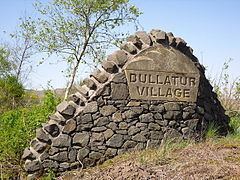
Dullatur is a village (population 520 (2004)) within the vicinity of Cumbernauld, Scotland. Its name is anglicised from the Gaelic "Dubh Leitir", which means dark slope. The route of the Antonine Wall passes just to the north of Dullatur, and a Roman camp was sited on the line of the wall at nearby Croy Hill.
Contents
Map of Dullatur, Glasgow, UK
The development of the village owed much to the creation of the Glasgow-Edinburgh railway line, with a station sited in Dullatur in 1842 to encourage commuters to settle there. Several grand villas were built as part of the original development, two of which were designed by the celebrated architect Alexander "Greek" Thomson.
The make up of the village was of the higher socio-economic class, and early recreational developments included golf and lawn-tennis clubs, both of which persist to the present day. The train station is now closed but the village still serves as a commuter settlement, with a number of new private properties having been built there in recent years.
Unlike other villages near Cumbernauld, Dullatur has not yet been subsumed into the town. However, this may happen in the future.