
Population 10 (2011 census) Duckinwilla BurgowanWalliebum | Postcode(s) 4650 Postal code 4650 | |
 | ||
Location 24 km (15 mi) NW of Maryborough45 km (28 mi) SW of Hervey Bay275 km (171 mi) N of Brisbane | ||
Duckinwilla is a locality in the Fraser Coast Region, Queensland, Australia. In the 2011 census, Duckinwilla had a population of 10 people.
Contents
Map of Duckinwilla QLD 4650, Australia
Geography
Duckinwalla is mostly forested much of it in the Wonga State Forest. There is some cleared land used for farming, but no urban area. The Bruce Highway passes from south to north through the eastern part of the locality. In the centre of the locality is Lake Lenthall, created by damming the Burrum River.
History
The earliest European settler in the district was Eli Lenthall, a timbergetter. Lake Lenthall is named after him.
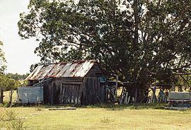
Heritage listings
Duckinwilla has a number of heritage-listed sites, including:
References
Duckinwilla, Queensland Wikipedia(Text) CC BY-SA