
Population 291 (2001) Sovereign state United Kingdom Local time Tuesday 8:02 AM Dialling code 28 | Irish grid reference H329743 Post town OMAGH Province Ulster | |
 | ||
Weather 1°C, Wind E at 8 km/h, 98% Humidity District Fermanagh and Omagh District Council | ||
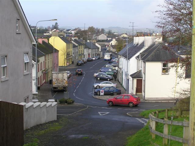
Drumquin (Irish: Droim Caoin (Pleasant ridge).) is a small village and townland (of 398 acres) in County Tyrone, Northern Ireland. It lies between Omagh and Castlederg, on the banks of the Drumquin River (Fairywater). It is situated in the civil parish of Longfield West and the historic barony of Omagh West. It had a population of 291 people in the 2001 Census.
Contents
- Map of Drumquin Omagh UK
- History
- Geography
- Places of Interest
- Sport
- 19th century population
- Drumquin Townland
- References
Map of Drumquin, Omagh, UK
History
It has a rich and varied historical legacy with a Neolithic stone circle, a Holy Well, and the Giant's Stone on Dooish Mountain. Those who are acquainted with the works of the noted Irish writer Benedict Kiely will be aware of his many references to the Drumquin district, with which he has family connections on his mothers side. In 1802, the countryside around Drumquin was described as one continuous scene of dreary mountains. However, the traveller did point out that forty years before that a rich coalmine had been opened at Drumquin and a canal opened to transport the coal. Drumquin has been in existence since 1211.
Sir John Davies founded the village itself in 1617, and the same gentleman built Castle Curlews, later called Castle Kirlish, the remains of which can be seen in the town land of that name. His agent was a man called Bradley, one of whose family was responsible in later times for the building of the fine stone house, which is a feature of the village today. It is interesting to note that Castle Kirlish was joined to Castlederg Castle by a straight causeway, which was seven miles (11 km) long. Traces of this causeway could still be observed in 1837.
Drumquin was also a stageing town in the 19th and early 20th century for coaches and travellers who were making their way to Derry from Omagh and vice versa. As a result of this the village flourished and hosted a hotel and several shops. Felix Kearney immortalised this area with songs such as "The Hills Above Drumquin" and others. On 26 August 1920, during the Irish War of Independence, the Irish Republican Army (IRA) attacked the Royal Irish Constabulary (RIC) barracks in Drumquin. One RIC constable and one IRA volunteer were killed.
Geography
The geography of the area is a mixture of flat fertile lands that clings to the banks of the Fairywater and steep rolling hills. There is also significant forests' to be found to the southwest of the village. Lough Bradan is also located roughly 7 miles from the village. The land is also covered in numerous rivers and streams and two rivers in particular meet on the outskirts of the village to form the river Fairywater.
The village itself is dominated by Dooish Mountain which is the highest point in the area. Close to the village Sloughan Glen Waterfalls can be found these rest in a deep ravine. Beyond the townland of Bradan lies miles of wet bogland that stretches to the border with County Fermanagh. In the area of the glen the land rises dramatically before falling again into the Fermanagh countryside. The area in general is also dotted with several quarries the biggest of these lying 2 miles outside of the village itself.
Places of Interest
Sport
19th century population
The population of the village decreased during the 19th century:
Drumquin Townland
The townland is situated in the historic barony of Omagh West and the civil parish of Longfield West and covers an area of 398 acres. The population of the townland declined during the 19th century:
The village of Drumquin is partly in the townland of the same name, and partly in townland of Drumnaforbe in the civil parish of Longfield East. In 1891 the village was estimated to cover an area of 12 acres.