
Country United States Time zone CST (UTC-6) Elevation 227 m Population 4,023 (2010) | Established March 1, 1869 ZIP codes 60936, 61845 Area 139 km² Local time Tuesday 1:47 AM | |
 | ||
Weather 17°C, Wind S at 42 km/h, 83% Humidity | ||
Drummer Township is one of twelve townships in Ford County, Illinois, USA. As of the 2010 census, its population was 4,023 and it contained 1,829 housing units.
Contents
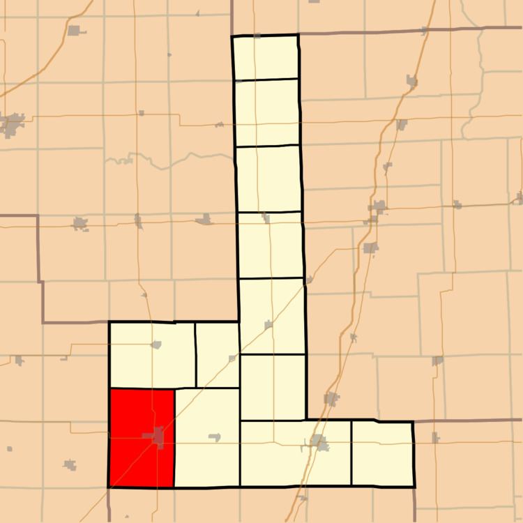
- Map of Drummer Township IL USA
- History
- Geography
- Cities towns villages
- Extinct towns
- Cemeteries
- Major highways
- Airports and landing strips
- School districts
- Political districts
- References
Map of Drummer Township, IL, USA
History
The township was formed from a portion of Dix Township (originally named Drummer Grove Township) on March 1, 1869. Drummer Township is named after a hunting dog called Drummer, who died while chasing a deer and was buried in what became known as Drummer Grove.
Geography
According to the 2010 census, the township has a total area of 53.66 square miles (139.0 km2), of which 53.47 square miles (138.5 km2) (or 99.65%) is land and 0.18 square miles (0.47 km2) (or 0.34%) is water.
Cities, towns, villages
Extinct towns
Cemeteries
The township contains Drummer Township Cemetery.
Major highways
Airports and landing strips
School districts
Political districts
References
Drummer Township, Ford County, Illinois Wikipedia(Text) CC BY-SA