
Sovereign state United Kingdom Local time Tuesday 5:01 AM | Country Wales Postcode district CF | |
 | ||
Weather 3°C, Wind W at 11 km/h, 90% Humidity | ||
Felix jaehn honka drope original
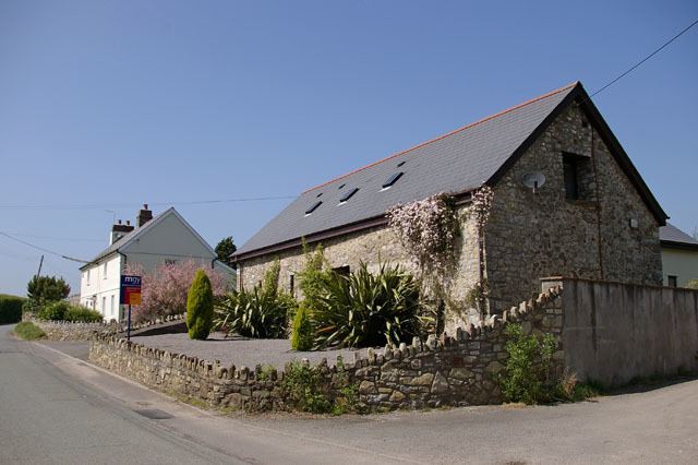
Drope is a hamlet in the valley of the River Ely in Vale of Glamorgan, southeast Wales, just beyond the territorial border of western Cardiff. It lies immediately east from Michaelston-super-Ely, west of Ely, Cardiff and southeast of St Georges-super Ely and is accessed via a bridge along Drope Road across the A4232 road to the north of Culverhouse Cross. Drope was designated a special conservation area in March 1973 by the former Glamorgan County Council due to its architectural heritage.
Contents
Map of Drope, Cardiff, UK
Drope sinistro x emicida
Landmarks
The farms of Drope, Ty Llwyd and Ty Uchaf and The Old Rectory in Drope have been identified as buildings which make a positive contribution to the special architectural or historic interest of the conservation area. The Old Rectory dates to the early Victorian period and set in landscaped gardens, it features a slate roof under local limestone walls.To the south is Coedarhydyglyn.