
Sovereign state United Kingdom Local time Monday 10:24 PM | Country Wales Dialling code 029 | |
 | ||
Weather 8°C, Wind W at 27 km/h, 79% Humidity | ||
Michaelston-super-Ely is a village, to the west of the city of Cardiff, Wales.
Map of Michaelston-super-Ely, Cardiff, UK
Its Welsh name is Llanfihangel-ar-Elai where llan church + Mihangel Saint Michael + Elai River Ely).
It is approximately half a mile from the boundary with the Vale of Glamorgan. To the north lies the village of St Fagans, and to the east the Ely estate. The community of Michaelston-super-Ely was joined with St Fagans in 1968.
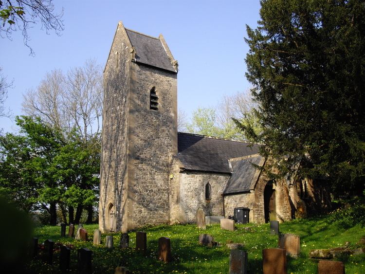
The historic St Michael's Church was decommissioned in 2010. It is a Grade II* listed building dating from the late 12th or early 13th-century.
References
Michaelston-super-Ely Wikipedia(Text) CC BY-SA