
Founded November 26, 1846 Population 18,785 (2013) Unemployment rate 7.1% (Apr 2015) | Named for Thomas Drew Area 2,165 km² | |
 | ||
Website drewcounty.arkansas.gov Rivers Bayou Bartholomew, Saline River, Haw Creek | ||
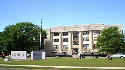
Drew County is a county located in the southeast region of the U.S. state of Arkansas. As of the 2010 census, the population was 18,509, making it the thirty-ninth most populous of Arkansas's seventy-five counties. The county seat and largest city is Monticello. Drew County was formed on November 26, 1846, and named for Thomas Drew, the 3rd governor of Arkansas.
Contents
Map of Drew County, AR, USA
Located on the edge of the Arkansas Timberlands and the Arkansas Delta, its fertile soils produced prosperity for early settlers in the antebellum era. Cotton was the major commodity crop, but corn, apples, peaches and tomatoes were also grown. Following the Civil War, the boundaries of Drew County changed.
In the late 19th and early 20th centuries, timber harvesting became an important industry. As a variety of industries began to move to the county, several colleges were founded in the county in the early part of the 20th century, one developing as University of Arkansas at Monticello. Today the county has a diverse economy and is an economic center in southeast Arkansas.
Geography
According to the U.S. Census Bureau, the county has a total area of 836 square miles (2,170 km2), of which 828 square miles (2,140 km2) is land and 7.3 square miles (19 km2) (0.9%) is water.
Loggy Bayou is a swamp in Drew County, not to be confused with a bayou of the same name in northwestern Louisiana.
Adjacent counties
Demographics
As of the 2000 United States Census, there were 18,723 people, 7,337 households, and 5,091 families residing in the county. The population density was 23 people per square mile (9/km²). There were 8,287 housing units at an average density of 10 per square mile (4/km²). The racial makeup of the county was 70.30% White, 27.16% Black or African American, 0.25% Native American, 0.42% Asian, 0.02% Pacific Islander, 1.00% from other races, and 0.85% from two or more races. 1.76% of the population were Hispanic or Latino of any race.
There were 7,337 households out of which 33.50% had children under the age of 18 living with them, 51.30% were married couples living together, 14.20% had a female householder with no husband present, and 30.60% were non-families. 26.00% of all households are made and 10.50% had someone living alone who was 65 years of age or older. The average household size was 2.46 and the average family size was 2.97.
In the county, the population was spread out with 25.80% under the age of 18, 12.60% from 18 to 24, 27.20% from 25 to 44, 21.50% from 45 to 64, and 12.80% who were 65 years of age or older. The median age was 34 years. For every 100 females there were 94.10 males. For every 100 females age 18 and over, there were 91.50 males.
The median income for a household in the county was $28,627, and the median income for a family was $37,317. Males had a median income of $30,794 versus $20,707 for females. The per capita income for the county was $16,264. About 13.10% of families and 18.20% of the population were below the poverty line, including 21.90% of those under age 18 and 21.80% of those age 65 or over.
Cities
Towns
Townships
Townships in Arkansas are the divisions of a county. Each township includes unincorporated areas; some may have incorporated cities or towns within part of their boundaries. Arkansas townships have limited purposes in modern times. However, the United States Census does list Arkansas population based on townships (sometimes referred to as "county subdivisions" or "minor civil divisions"). Townships are also of value for historical purposes in terms of genealogical research. Each town or city is within one or more townships in an Arkansas county based on census maps and publications. The townships of Drew County are listed below; listed in parentheses are the cities, towns, and/or census-designated places that are fully or partially inside the township.
Source: