
Founded April 17, 1873 Area 1,551 km² Unemployment rate 6.3% (Apr 2015) | Population 8,593 (2013) | |
 | ||
Website clevelandcounty.arkansas.gov Rivers Saline River, Mill Creek, Moro Creek, Fritz Creek | ||
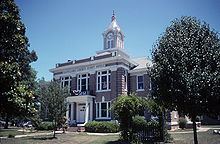
National register of historic places listings in cleveland county arkansas top 5 facts
Cleveland County (formerly Dorsey County) is a county located in the U.S. state of Arkansas. Its population was 8,689 at the 2010 U.S. census. The county seat is Rison.
Contents
- National register of historic places listings in cleveland county arkansas top 5 facts
- Map of Cleveland County AR USA
- History
- Geography
- Adjacent counties
- Demographics
- Cities
- Census designated places
- Townships
- Notable people
- References
Map of Cleveland County, AR, USA
Cleveland County is included in the Pine Bluff, AR Metropolitan Statistical Area, which is also included in the Little Rock-North Little Rock, AR Combined Statistical Area.
History
The Arkansas legislature established Dorsey County as Arkansas's 71st county on April 17, 1873, naming it for Stephen W. Dorsey, the U.S. Senator from Arkansas. When he was indicted for defrauding the Post Office, they renamed it on March 5, 1885, for Grover Cleveland, the newly elected President of the United States.
The Battle of Mark's Mills, the pivotal engagement in the Union Army's ill-fated Camden Expedition during the U.S. Civil War, took place in what is now Cleveland County. This engagement resulted in a crushing victory for Confederate forces, though the victory ultimately proved to be hollow when Federal General Frederick Steele and the rest of his army managed to escape from Camden to Little Rock.
Geography
According to the U.S. Census Bureau, the county has a total area of 599 square miles (1,550 km2), of which 598 square miles (1,550 km2) is land and 1.0 square mile (2.6 km2) (0.2%) is water.
Adjacent counties
Demographics
As of the 2000 United States Census, there were 8,571 people, 3,273 households, and 2,513 families residing in the county. The population density was 14 people per square mile (6/km²). There were 3,834 housing units at an average density of 6 per square mile (2/km²). The racial makeup of the county was 84.79% White, 13.22% Black or African American, 0.32% Native American, 0.14% Asian, 0.04% Pacific Islander, 0.68% from other races, and 0.83% from two or more races. 1.62% of the population were Hispanic or Latino of any race.
There were 3,273 households out of which 34.90% had children under the age of 18 living with them, 62.70% were married couples living together, 9.90% had a female householder with no husband present, and 23.20% were non-families. 21.40% of all households were made up of individuals and 10.00% had someone living alone who was 65 years of age or older. The average household size was 2.60 and the average family size was 3.00.
In the county, the population was spread out with 26.20% under the age of 18, 7.90% from 18 to 24, 27.70% from 25 to 44, 24.70% from 45 to 64, and 13.60% who were 65 years of age or older. The median age was 37 years. For every 100 females there were 95.40 males. For every 100 females age 18 and over, there were 93.20 males.
The median income for a household in the county was $32,405, and the median income for a family was $38,164. Males had a median income of $31,282 versus $21,172 for females. The per capita income for the county was $15,362. About 11.40% of families and 15.20% of the population were below the poverty line, including 21.50% of those under age 18 and 15.70% of those age 65 or over.
Cities
Census-designated places
Townships
Townships in Arkansas are the divisions of a county. Each township includes unincorporated areas; some may have incorporated cities or towns within part of their boundaries. Arkansas townships have limited purposes in modern times. However, the United States Census does list Arkansas population based on townships (sometimes referred to as "county subdivisions" or "minor civil divisions"). Townships are also of value for historical purposes in terms of genealogical research. Each town or city is within one or more townships in an Arkansas county based on census maps and publications. The townships of Cleveland County are listed below; listed in parentheses are the cities, towns, and/or census-designated places that are fully or partially inside the township.