
Time zone EET (UTC+2) Vehicle registration Z Area code 210 | Elevation 20 m (70 ft) Postal code 186 xx Local time Monday 10:08 PM | |
 | ||
Weather 16°C, Wind W at 0 km/h, 57% Humidity | ||
haunted factory drapetsona greek ghosthunters paranormal research
Drapetsona (Greek: Δραπετσώνα) is a suburb and a former municipality in the southwestern part of the Athens-Piraeus agglomeration, Greece. Since the 2011 local government reform it is part of the municipality Keratsini-Drapetsona, of which it is a municipal unit.
Contents
- haunted factory drapetsona greek ghosthunters paranormal research
- Map of Drapetsona Greece
- Geography
- History
- References
Map of Drapetsona, Greece
Geography
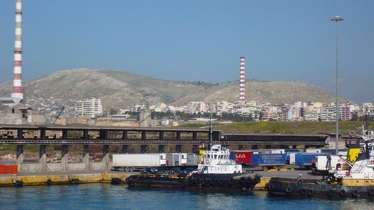
Drapetsona is situated on the north side of the inlet to the Port of Piraeus. The northwestern part of the port is on the territory of Drapetsona. Drapetsona lies 1.5 km west of Piraeus city centre, and 10 km southwest of Athens city centre. The municipal unit has an area of 1.725 km2. Its built-up area is continuous with those of Piraeus and the neighbouring suburb Keratsini.
History
In 1805 the first church, Saint Dionysios was built. In the 1830s Drapetsona was constituted of people who moved from Greek islands and settled near Saint Dionysios church in the area called Vourla. In 1834 a part of the region was given to Piraeus in order to become a cemetery under the term of churches’ reconstruction. Also a great number of brothels was established in 1873 to the west of Saint Dionysios. After the 1922 Asia Minor Catastrophe there was a notable population increase.
Drapetsona was part of the municipality of Piraeus until 1950, when it became a separate community. It was elevated to municipality status in 1951.
Since 19th century Drapetsona has become an important part of the Piraeus industrial area. The first major port facility was the Vasileiadis Shipyard, founded in 1898. Subsequently, other industries were established: a fertilizer factory, a plaster factory, a cement factory, a tannery and more recently installations of petroleum companies (Shell, Mobil, BP).
There are plans to redevelop a 64 hectares (160 acres) section of the Drapetsona seafront on the Saronic Gulf for tourism and water sports. The plans include a Maritime Business Centre and two marinas.