
GNIS feature ID 0467739 Area 96.68 km² Population 465 (2010) | Time zone CST (UTC-6) Elevation 294 m Local time Friday 7:20 PM | |
 | ||
ZIP codes 52133, 52135, 52141, 52161, 52175 Weather -7°C, Wind NW at 16 km/h, 37% Humidity | ||
Dover Township is one of twenty townships in Fayette County, Iowa, USA. As of the 2010 census, its population was 465.
Contents
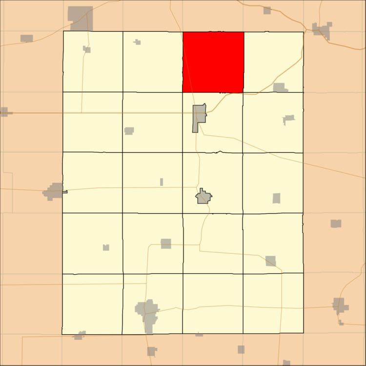
- Map of Dover IA USA
- Geography
- Unincorporated towns
- Adjacent townships
- Cemeteries
- Major highways
- Landmarks
- School districts
- Political districts
- References
Map of Dover, IA, USA
Geography
According to the United States Census Bureau, Dover Township covers an area of 37.33 square miles (96.68 square kilometers).
Unincorporated towns
(This list is based on USGS data and may include former settlements.)
Adjacent townships
Cemeteries
The township contains these six cemeteries: Auburn Township, Bethany, Dover Township, George, Nutting and Saint Peter.
Major highways
Landmarks
School districts
Political districts
References
Dover Township, Fayette County, Iowa Wikipedia(Text) CC BY-SA