
Postal code. 02400~02699 Population 346,770 (2010) | Region Sudogwon Administrative dong 14 Area 14.22 km² Local time Friday 5:01 PM | |
 | ||
Time zone Korea Standard Time (UTC+9) Weather 10°C, Wind W at 16 km/h, 21% Humidity Colleges and Universities Kyung Hee University, Hankuk University of Foreig, University of Seoul, KDI School of Public Policy an | ||
Dongdaemun District (Dongdaemun-gu) is one of the 25 gu (districts) of Seoul, South Korea. It is located to the north of the River Han. Its district office is in Yongdu-dong where is close to the underground station of branch of Line 2.
Contents
- Map of Dongdaemun gu Seoul South Korea
- History
- Administrative divisions
- Underground
- Geography
- Universities
- Research
- Attractions
- Sister cities
- References
Map of Dongdaemun-gu, Seoul, South Korea
The mayor of this district is Sarip Hong (홍사립) since July 2006.
History
Dongdaemun District was first created in 1943 when the "gu" system started and was larger in area than today. Seongbuk District separated from the district in 1949, and Changsin Dong and Sungin Dong were given to Jongno District in 1975. An additional 17 dong (neighborhoods) separated to become Jungnang District in 1988.
Administrative divisions
Dongdaemun District currently comprises 14 dongs.
Underground
There are more stations will add.
Geography
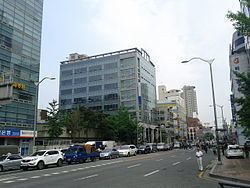
Dongdaemun District borders Seongbuk District to the north-west, Jungnang District to the east (with the Jungnangcheon stream forming the border), Gwangjin District to the south-east, Seongdong District to the south, meets Jung District at a point in the south-west and borders Jongno District to the west. The busiest neighbourhood of the district is the Cheongnyangni area - a large commercial zone formed around Cheongnyangni Station, one of the secondary CBDs of Seoul. Dongdaemun District is named after the east gate in Seoul's city walls, Dongdaemun, but Dongdaemun itself is actually located in Jongno District. This is due to an administrative border change.
Universities
Research
Attractions
The grave sites of Kim Byeongro (김병로 金炳魯), Han Yongwoon (한용운 韓龍雲), Ahn Changho and Oh Sechang (오세창 吳世昌) are also located in this district.