
OS grid reference SD518536 Post town LANCASTER Local time Thursday 6:36 PM Dialling code 01524 | Postcode district LA2 | |
 | ||
Weather 7°C, Wind SW at 6 km/h, 79% Humidity Civil parishes | ||
Dolphinholme is a historic village in Lancashire, North West England.
Contents
Map of Dolphinholme, Lancaster, UK
History
In the 18th and 19th centuries the village played an important part in the Industrial Revolution. Slave trader Thomas Hinde founded a mill in Lower Dolphinholme in 1795. This worsted mill prospered and the lower village was amongst the first in the United Kingdom to have gas lighting. Pollution was fed away from the village underground to the mill's chimney which was located in a nearby field.
Geography
The village, designated as a historic conservation area, is split into two parts – a higher village and a lower part, called Lower Dolphinholme, situated on the River Wyre. The river is the boundary between the Lancaster and Wyre districts. Dolphinholme sits on the edge of the Forest of Bowland and is less than five miles away from Lancaster.
Transport links
It is only 2½ miles from Junction 33 of the M6 motorway. The nearest railway station is Lancaster.
Community
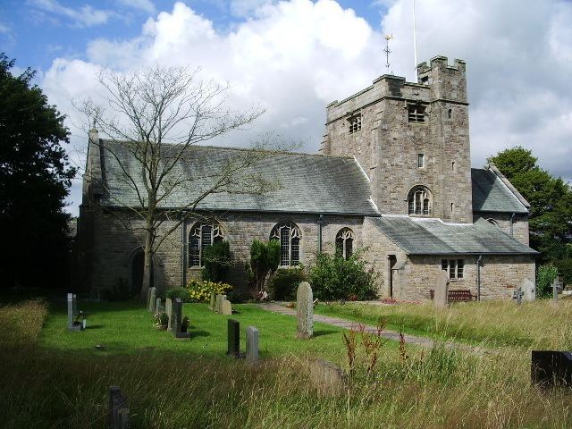
The village has a school (Dolphinholme Church of England Primary School), a village hall, a parish church (St Mark's C of E), a Methodist chapel, a pub (the Fleece Inn), a recreational ground, a tennis court, a bowling green and a garage (Rogerson's).
Most of the historic lower village is still intact, the remains of the mill are in what is now a private garden but the chimney is still standing, in a nearby field. A warehouse, associated with the mill has been converted into housing although it has been (somewhat confusingly) named 'The Mill'.