
Population 4,895 (2011) Civil parish Ellel Dialling code 01524 | OS grid reference SD485560 Sovereign state United Kingdom | |
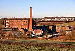 | ||
Ellel is a village and civil parish in the City of Lancaster in the English county of Lancashire. It has a population of 2,521, increasing to 4,895 at the 2011 Census. The parish includes the villages of Bay Horse, Galgate and Hampson Green, and part of Dolphinholme.
Contents
Map of Ellel, Lancaster, UK
The disused Church of St Mary was built on Ellel Grange estate in 1873 by W. & G. Audsley.
Governance
An electoral ward in the same name exists. This ward stretches to Abbeystead in the east with a total population taken at the 2011 Census of 6,854.
References
Ellel, Lancashire Wikipedia(Text) CC BY-SA