
Demonym(s) Dolcedesi Local time Thursday 3:50 PM | Elevation 75 m (246 ft) Area 19.32 km² Postal code 18100 | |
 | ||
Frazioni Bellissimi, Castellazzo, Costa Carnara, Isolalunga, Lecchiore, Magliani, Monte Faudo, Ripalta, Santa Brigida, Trincheri Weather 13°C, Wind SW at 19 km/h, 68% Humidity | ||
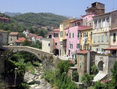
Dolcedo is a comune (municipality) in the Province of Imperia in the Italian region Liguria, located about 100 kilometres (62 mi) southwest of Genoa and about 7 kilometres (4 mi) northwest of Imperia.
Contents
Map of 18020 Dolcedo Province of Imperia, Italy
The communal seat, Piazza, is located in the lower valley of the Prino stream. The other main centers are Isolalunga, Costa Carnara, Bellissimi and Lecchiore. Dolcedo borders the following municipalities: Badalucco, Civezza, Imperia, Montalto Ligure, Pietrabruna, Prelà, Taggia, and Vasia.
History
The boroughs of Dolcedo appeared in the early Middle Ages, populated by refugees from the Ligurian coast. Later it was a fief of the Clavesana family. In the 12th century cultivation of olive became a mainstay of the area. In 1228 the Clavesana ceded their lands to the commune of Genoa.