
Country Thailand Time zone ICT (UTC+7) Geocode 5605 Province Phayao Province | Seat Don Si Chum Postal code 56120 Area 823.3 km² | |
 | ||
Dok Khamtai (Thai: ดอกคำใต้; [dɔ̀ːk kʰāmtâːj]) is a district (amphoe) of Phayao Province in northern Thailand.
Contents
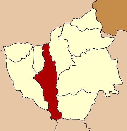
Map of Dok Khamtai District, Phayao, Thailand
History
Originally created in 1832, the district was abolished on 23 December 1917 and incorporated into Phayao district. It was recreated as a minor district (king amphoe) on 23 January 1963. It was finally upgraded back to a full district on July 27, 1965.
Etymology
Dok Khamtai is the Thai name of the sponge tree (Acacia farnesiana (L.) Willd.).
Geography
Neighboring districts are (from the north clockwise) Pa Daet of Chiang Rai Province, Chun, Pong and Chiang Muan of Phayao Province, Song of Phrae Province, Ngao of Lampang Province, and Mueang Phayao and Phu Kamyao of Phayao again.
The main water course is the Ing River. Doi Phu Nang National Park is in the district.
Administration
The district is divided into 12 sub-districts (tambon), which are further subdivided into 124 villages (muban). There are two townships (thesaban tambon). Dok Khamtai covers parts of tambon Dok Khamtai, Don Si Chum, Sawang Arom, and the whole tambon Bun Koet. Ban Tham covers the whole tambon Ban Tham. There are further nine tambon administrative organizations (TAO).