
Special City Seoul Postal code 01300~01599 Local time Thursday 4:04 PM | Region Sudogwon Administrative dong 14 Area 20.8 km² Population 348,625 (2010) | |
 | ||
Time zone Korea Standard Time (UTC+9) Weather 9°C, Wind W at 23 km/h, 31% Humidity University Duksung Women's University Points of interest Wontongsa Temple, Dobongsan, Seoul Iris Garden | ||
Dobong district lantern festival in seoul travel korea
Dobong District (Dobong-gu) is one of the 25 districts (gu) of Seoul, South Korea. It is located on the north side of the Han River.
Contents
- Dobong district lantern festival in seoul travel korea
- Map of Dobong gu Seoul South Korea
- Symbols
- Mountain
- Administrative divisions
- Railroad
- Sister cities
- References
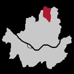
Map of Dobong-gu, Seoul, South Korea
Symbols
Mountain
Dobongsan Mountain is a mountain in Bukhansan National Park, partly under the jurisdiction of Dobong-gu. It is a popular leisure spot for district residents.
In addition, Dobongsan Mountain has many large and small temples such as Cheonchuksa, Wontongsa, and Manweolam.
Administrative divisions
Dobong-gu is composed of four dong.
Railroad
Sister cities
References
Dobong District Wikipedia(Text) CC BY-SA