
Country Algeria Elevation 41 m (135 ft) Area 780 km² | Time zone CET (UTC+1) Population 50,916 (2008) | |
 | ||
Djamaa (Arabic: ﺟﺎﻣﻌﺔ) (also written Jama'a) is a town and commune in El Oued Province, Algeria. According to the 2008 census it has a population of 50,916, up from 37,438 in 1998, with an annual growth rate of 3.1%.
Contents
Map of Djamaa, Algeria
Geography
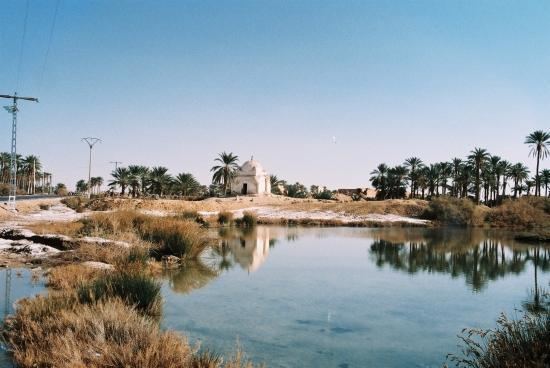
To the east of Djamaa is a large area of palm plantations. The locality of Tigdidine lies amongst the palm trees. To the west the landscape is mostly arid and sandy, although there is another smaller palm plantation about 3 kilometres (1.9 mi) west of the town.
Climate
Djamaa has a hot desert climate (Köppen climate classification BWh), with very hot summers and mild winters, and very little precipitation throughout the year.
Transportation
Djamaa has a station on the Biskra-Touggourt railway line. The N3 highway passes through the town, also connecting Biskra in the north to Touggourt in the south.
Education
6.5% of the population has a tertiary education, and another 16.1% has completed secondary education. The overall literacy rate is 80.7%, and is 86.3% among males and 75.2% among females.
Localities
The commune of Djamaa is composed of five localities: