
Total length 1,053 m (3,455 ft) Opened 1993 | Design Truss Address Bridgeton, MO 63044, USA | |
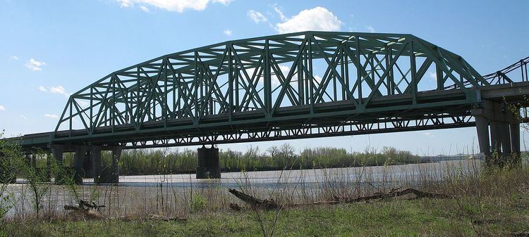 | ||
Carries 6 lanes (currently 8) of Route 370 Similar Wabash Bridge, Veterans Memorial Bridge, Old St Charles Bridge, Lewis Bridge, Bellefontaine Bridge | ||
The Discovery Bridge is a pair of truss bridges carrying Missouri Route 370 across the Missouri River between St. Louis County and St. Charles County, Missouri.
The shoulder on both sides is designated a bicycle (and pedestrian) path. Separate bicycle/pedestrian access ramps are available immediately on both sides of the bridge. This provides a connection to traffic to and from the Katy Trail, which passes under the bridge.
The bicycle lane and shoulders were converted into an extra travel lane in each direction in November 2011 due to the rehabilitation of the westbound Blanchette (I-70) Bridge and the bridge was closed for bicycle and pedestrian use. The alternative river crossing was the Veterans Memorial (Page Ave) Bridge, adding about 15 miles distance to trips involving a river crossing. The bicycle/pedestrian lanes reopened in May 2014.