
Population 5,491 (2011 census) Sovereign state United Kingdom Local time Tuesday 10:47 PM | OS grid reference NH550587 Post town DINGWALL Dialling code 01349 | |
 | ||
Weather 4°C, Wind S at 5 km/h, 86% Humidity University | ||
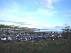
Old photographs of dingwall scotland
Dingwall (Scots: Dingwal, Scottish Gaelic: Inbhir Pheofharain) is a town and former royal burgh in the Highland council area of Scotland. It has a population of 5,491. It was formerly an east-coast harbour but now lies inland. Dingwall Castle was once the biggest castle north of Stirling. On the town's present-day outskirts lies Tulloch Castle, parts of which may date back to the 12th-century building. In 1411 the Battle of Dingwall is said to have taken place between the Clan Mackay and the Clan Donald.
Contents
- Old photographs of dingwall scotland
- Map of Dingwall UK
- The victoria dingwall restaurant opening night launch
- History
- Sports
- Amenities
- Parliamentary burgh
- References
Map of Dingwall, UK
The victoria dingwall restaurant opening night launch
History
Its name, derived from the Scandinavian Þingvöllr (field or meeting-place of the thing, or local assembly; compare Tynwald, Tingwall, Thingwall in the British Isles alone, plus many others across northern Europe), preserves the Viking connections of the town; Gaels call it Inbhir Pheofharain (pronounced [iɲiɾʲˈfjɔhəɾaiɲ]), meaning "the mouth of the Peffery" or Baile Chàil meaning "cabbage town".
The site of the Þingvöllr, and of the medieval Moothill, lies beneath the Cromartie memorial.
Dingwall formerly served as the county town of the county of Ross and Cromarty. It lies near the head of the Cromarty Firth where the valley of the Peffery unites with the alluvial lands at the mouth of the Conon, 14 miles (23 km) northwest of Inverness.
In the early Middle Ages Dingwall was reputed to have the largest castle north of Stirling.
King Alexander II created Dingwall a royal burgh in 1226, and James IV renewed its charter. On the top of Knockfarrel (Gaelic: Cnoc Fhearghalaigh), a hill about three miles (5 km) to the west, stands a large and very complete vitrified fort with ramparts.
The 18th-century town house, and some remains of the ancient mansion of the once powerful earls of Ross, still exist. An obelisk, 51 feet (16 m) high, was erected over the grave of Sir George Mackenzie, 1st Earl of Cromartie, near the parish church of St Clement. It was affected by subsidence, becoming known as the "Leaning Tower", and was replaced by a much smaller replica in the early years of the 20th century. However even this is now marked by signs saying "Keep Out" on the grounds that it is a dangerous structure.
Dingwall suffered widespread flooding during storms in late October 2006, during which the weather cut off much of the Highlands north of Inverness, including the A9 and Far North Line for a significant period of time.
Sports
Dingwall is the home of football team Ross County, who won promotion to the Scottish Premier League in 2012 and finished the 2012/13 season in fifth place. Despite the town's small population, Ross County attract sizeable crowds to Victoria Park thereby maintaining the UK's most northerly full-time squad. The team reached the 2010 Scottish Cup Final, having knocked out Celtic in the previous round. Over 17,000 Staggies fans travelled to the match.
Ross County won their first piece of silverware in 2016 by winning the Scottish League Cup beating Hibernian 2-1 in the final .
Amenities
Dingwall railway station has lain on what is now called the Far North Line since circa 1865. It also serves the Kyle of Lochalsh Line, with the junction between the two lines being located within the town. The station is served with around 26 trains a day, 14 of which go to Inverness. The town contains the shortest and most northerly canal in the UK, the Dingwall Canal.
The majority of the High Street is pedestrianised. On the outskirts of Dingwall a new mini shopping mall, named DingMall, opened in November 2012.
The Highland Theological College is located within the town. It is part of the University of the Highlands and Islands and has been approved by the Church of Scotland, the United Free Church and other denominations as a training provider for those entering ministry.
Parliamentary burgh
Dingwall was a parliamentary burgh, combined with Dornoch, Kirkwall, Tain and Wick in the Northern Burghs constituency of the House of Commons of the Parliament of Great Britain from 1708 to 1801 and of the Parliament of the United Kingdom from 1801 to 1918. Cromarty was added to the list in 1832.
The constituency was a district of burghs known also as Tain Burghs until 1832, and then as Wick Burghs. It was represented by one Member of Parliament. In 1918 the constituency was abolished and the Dingwall component was merged into the county constituency of Ross and Cromarty.