
Population 1,934 (in 2011) Unitary authority Local time Tuesday 7:19 PM | OS grid reference ST850498 Region South West Sovereign state United Kingdom Dialling code 01373 | |
 | ||
Weather 8°C, Wind S at 16 km/h, 82% Humidity | ||
Dilton marsh england s smallest railway station
Dilton Marsh is a village and civil parish in the county of Wiltshire, in the southwest of England. The village is about 1.5 miles (2.4 km) southwest of the centre of the town of Westbury; expansion of the town has brought its Westbury Leigh suburb almost to the parish boundary.
Contents
- Dilton marsh england s smallest railway station
- Map of Dilton Marsh UK
- Meet the cast it s a good day girl may 1940 s show dilton marsh
- Location
- History
- Religious sites
- Features
- Governance
- Transport
- References
Map of Dilton Marsh, UK
The parish is on the county border with Somerset. It includes the small settlements of Penknap (east of Dilton Marsh village); Stormore (now contiguous with the west of the village); Clearwood (a little further west); and the rural hamlets of Fairwood (north) and Hisomley (southwest).
Meet the cast it s a good day girl may 1940 s show dilton marsh
Location
To the west is the Somerset town of Frome, the garrison town of Warminster is to the southeast, and Wiltshire's county town of Trowbridge is to the north. The Somerset border is some 1.5 miles (2.4 km) to the west of Dilton Marsh village.
History
The original settlement, Old Dilton, is some 3⁄4 mi (1.2 km) southeast of the present village centre at grid reference ST860490, on the banks of the Biss Brook. It now consists of a couple of farm houses and the ancient St Mary's Church. As fewer workers were needed in the local woollen industry after the introduction of greater mechanisation, many moved to the common land of the drained marsh on the northern side of the ridge. By the early 19th century, Dilton Marsh had outgrown the older settlement.
Dilton Marsh was a tithing of the ancient parish of Westbury, and the church at Dilton (now Old Dilton) was a chapelry of the parish church at Westbury. Dilton Marsh civil parish was created in 1894, bounded on the east by the Biss Brook and on the west by the county boundary; the southern extent of the new parish was reduced in 1934 when Chapmanslade civil parish was created.
Chalcot House, a Grade II* listed country house, stands in Chalcot Park in the south of the parish. The house was built in the early 18th century on the site of an older one, extensively altered in 1872 by James Piers St Aubyn, and restored in the 1970s.
Dilton Marsh had two schools in the 19th century. A British School was built in 1866, enlarged in 1884 and 1895, and became a County school 1906. A National School was built next to the new church c. 1848, and became a County school in 1904, when it was known as the Church of England school. The schools took children of all ages until the 1930s, when those over 11 transferred to the secondary school at Westbury. In 1938 the sites were reorganised into an Infants' school at the former British School, and a Junior school at the church school.
Religious sites
St Mary's Church, Old Dilton is from the 14th century, with later work in the 15th and 17th; its interior is little changed since the 18th. Regular services ceased in 1900 after the building of Holy Trinity at Dilton Marsh, and the church was declared redundant in 1973. A Grade I listed building, it is now in the care of the Churches Conservation Trust.
Holy Trinity Church was built in the centre of the village in 1844, to designs of T.H. Wyatt in Romanesque style, largely at the expense of Thomas Phipps of Chalcot. The building is Grade II* listed. Holy Trinity is today part of the White Horse Team Ministry.
Providence Baptist Church at Penknap was built in 1810, after a dispute at Westbury Leigh Baptist Church. The building was enlarged in 1835 and continues in use. Stormore Chapel was built in 1844 as an offshoot of the Westbury Leigh Church, replacing a smaller building of 1839 which was provided owing to the distance from Penknap and Westbury. This too continues in use.
Features
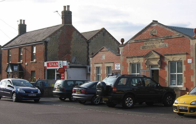
The village High Street is 2 km (2187 yd) long. The village has a public house (the Prince of Wales), a post office, grocery shop, fish & chip shop and farm shop/garden centre & cafe (Fairfield Farm College). The village school continues as Dilton Marsh Church of England Primary School, in new accommodation built in 1988 behind the former church school.
Governance
The village forms part of Ethandune electoral ward. This ward passes to the north of Westbury, then visits Bratton before finishing in Coulston. The total population of the ward as at the 2011 census was 4,526.
Transport
At the eastern end of the village is Dilton Marsh Railway Station, a simple railway platform on the regional line. It is the subject of the John Betjeman poem Dilton Marsh Halt. This is a request stop which means you have to ask the conductor to stop there, and when you want to get on a train you hold your hand as if hailing a taxi; you will have to pay on board as there are no facilities to pay at the platform.
In the past passengers were directed to the seventh house up the hill, Holmdale, where tickets could be bought from Mrs H. Roberts acting as a ticket agent for British Rail.