
Admin. region Freiburg Time zone CET/CEST (UTC+1/+2) Area 42.25 km² Local time Tuesday 1:06 PM Dialling code 7404 | District Rottweil Postal codes 78661 Population 3,948 (31 Dec 2008) Postal code 78661 Administrative region Freiburg | |
 | ||
Weather 3°C, Wind W at 18 km/h, 86% Humidity | ||
Dietingen is a municipality in the district of Rottweil, in Baden-Württemberg, Germany.
Contents
- Map of 78661 Dietingen Germany
- Geography
- Neighboring communities
- Municipality arrangement
- Crests of the former municipalities
- Tourist trains on weekends in the summer
- Freeman
- References
Map of 78661 Dietingen, Germany
Geography
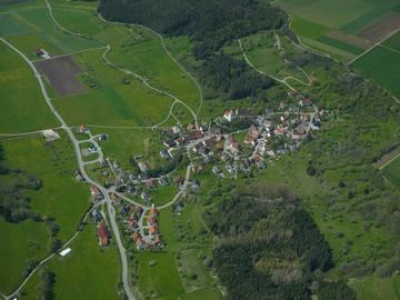
Dietingen is located in the Upper Neckar valley between the Black Forest and the Swabian Jura in 544–623 meters altitude, about five kilometers away from the town of Rottweil.
Neighboring communities
The municipality borders to Epfendorf, on the east to Rosenfeld and Zimmern unter der Burg in the Zollernalbkreis, in the south to the county town Rottweil and in the west to Villingendorf.
Municipality arrangement
The municipality Dietingen includes the formerly independent municipalities Böhringen, Gößlingen, Irslingen and Rotenzimmern.
In the hamlet of Irslingen is situated Burgstall Tierstein respectively castle Wildeck.
Crests of the former municipalities
Tourist trains on weekends in the summer
About Schömberg and Balingen the station Rotenzimmern can be reached over a wheel hiking shuttle from Tübingen. (free bicycle transport on weekends and holidays in the summer). The Hohenzollerische Landesbahn reaches with coupled railcars from Tübingen to Kleinengstingen the Upper Danube Nature Park and continues by bus till the starting point of the Schlichem hiking trail in Tieringen. Since 2015 an early train allows full-day excursions. Less experienced hikers can divide the Schlichem hiking trail in stages.
Freeman
Franz Müller, mayor, received at its adoption in January 1968, the Order of Merit of the Federal Republic of Germany.