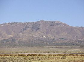
Topo map USGS DIAMOND PEAK Prominence 1,096 m Parent range Diamond Mountains | Elevation 3,240 m Mountain range Diamond Mountains | |
 | ||
Easiest route From Newark Summit, north along a 4-wheel drive road and then the ridgeline, Class 2 scramble Similar Matterhorn, Troy Peak, Hole in the Mountain Peak, Currant Mountain, Bunker Hill | ||
Diamond Peak is both the highest and most topographically prominent mountain in both the Diamond Mountains and Eureka County, in Nevada, United States. It ranks thirty-ninth among the most topographically prominent peaks in the state. The peak is located on the border of Eureka County and White Pine County, about 12 miles northeast of the small town of Eureka, between the south end of Diamond Valley and the central portion of Newark Valley. It is on public land administered by the Bureau of Land Management and thus has no access restrictions.
Map of Diamond Peak, Nevada, USA
References
Diamond Peak (Nevada) Wikipedia(Text) CC BY-SA
