
Basin size 508 km (196 sq mi) Basin area 508 km² | Length 54 km | |
 | ||
Main source Plateau de Millevaches770 m (2,530 ft) River mouth Dordogne400 m (1,300 ft) Discharge Average rate:12 m/s (420 cu ft/s) | ||
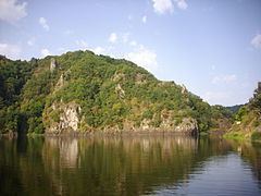
The Diège (Occitan: Dieja) is a 54.4 km (33.8 mi) long river in the Corrèze département, south central France. Its source is at Saint-Setiers, on the plateau de Millevaches, in the parc naturel régional de Millevaches en Limousin. It flows generally southeast. It is a right tributary of the Dordogne into which it flows between Roche-le-Peyroux and Saint-Julien-près-Bort, 68 km (42 mi) southwest of Clermont-Ferrand.
Contents
Map of La Di%C3%A8ge, France
Its main tributary is the Liège.
Communes along its course
This list is ordered from source to mouth:
References
Diège Wikipedia(Text) CC BY-SA