
Country State | District Tirupur | |
 | ||
Languages spoken Time zone, IST, UTC+5:30 | ||
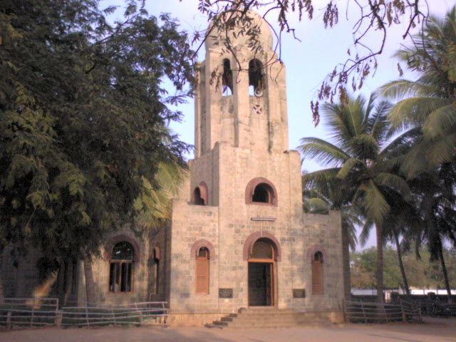
Map of Dharapuram
Dharapuram is a town in Tirupur district in the Indian state of Tamil Nadu. Dharapuram is one of the oldest towns in Tamil nadu and was the capital of Kongu Nadu under the Cheras, Western Ganga Dynasty and later Kongu Cholas, at which time it was known as Vanchipuri. Amaravathi River flows through the town. As of 2011, the town had a population of 67,007.
Contents
- Map of Dharapuram
- Airavatheswarar swamytemple dharapuram kombakonam
- History
- Geography
- Demographics
- Geography and climate
- Economy
- Administration and politics
- Transport
- Places of interest
- Notable people
- References
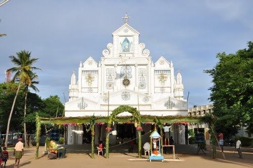
Airavatheswarar swamytemple dharapuram kombakonam
History
Dharapuram was part of the Chera kingdom until 850 A.D. From 1000 A.D. to 1275 A.D., the area was ruled by the Kongu Cholas under the name Vanchipuri. The Cholan capital was under attack by a hitherto unknown group in South India, called Kalabhars. As a result, the Kongu Cholas made Dharapuram their military and political headquarters. The Later Cholas named the city as Rajarajapuram. After 1276 A.D. the Pandyas took control of the region. The Sultanate, Nayaks of Madurai and Vijayanagara empire rules followed by Hyder Ali and Tippu Sultan. In 1799, when Tippu fell to the British, the East Indian Company took over administration of this region.
Dharapuram attained the status of a Municipality in the year 1916 and it was promoted to first grade municipality on May 9, 1983.
Geography
Dharapuram town is situated along 19.62 km2 of the bank of Amaravathi River which flows from the south to north. Uppar River, Nallathankal River, Palar join the river Amaravathi.
Demographics
According to 2017 census, Dharapuram had a population of 1,65,007 with a sex-ratio of 1,045 females for every 1,000 males, much above the national average of 929. A total of 5,048 were under the age of six, constituting 2,566 males and 2,482 females. Scheduled Castes and Scheduled Tribes accounted for 21.48% and .1% of the population respectively. The average literacy of the town was 80.4%, compared to the national average of 72.99%. The town had a total of 15842 households. This area is dominated by kongu vellalar gounders, There were a total of 23,722 workers, comprising 506 cultivators, 1,227 main agricultural laborers, 652 in house hold industries, 17,553 other workers, 3,784 marginal workers, 51 marginal cultivators, 697 marginal agricultural laborers, 204 marginal workers in household industries and 2,832 other marginal workers. As per the religious census of 2011, Dharapuram (M) had 77.12% Hindus, 16.76% Muslims, 5.74% Christians, and 0.37% following other religions.
Geography and climate
Dharapuram is located at 10.73°N 77.52°E / 10.73; 77.52. It has an average elevation of 245 metres (803 feet). It is strategically located in the line of Palakkad pass which provides the wind that activates the town's numerous windmills. The area has a significant water shortage.The town features a hot semi-arid climate (Köppen climate classification;BSh).
Economy
Agriculture is the primary industry in Dharapuram. There are textile mills, rice mills, oil processing plants.
Administration and politics
Dharapuram has been reserved constituency from 1967 to still day. The assembly constituency (SC) is part of Erode (Lok Sabha constituency). V.S.Kalimuthu is a present member of the Tamil Nadu Legislative Assembly from the Dharapuram constituency. Dharapuram Revenue division consists of Dharapuram taluk and Kangeyam taluk.
Transport
The following are the major highways connecting Dharapuram:
Dharapuram is connected by moffusil bus services to major towns in Tamil Nadu operated by TNSTC. The nearest railway station is Palani (35 km) and the nearest airport is Coimbatore International Airport (80 km).
Places of interest
Agastheeswarar temple, Kadu Hanumantharaya Swami temple, Bhagavan Koil, Angalamman temple, Kottai Mariamman temple, Rathinamoorthy temple, Thean Easwaran temple, Periya Nachiamman temple, Konguvadukanatha Swami temple,Thillapuriamman Temple, Chakrathalvar temple, Mamangam temple and Angitholuvu Kaliamman temple are the major places of worship.