
Total islands 1 Length 5.5 km (3.42 mi) Area 4.027 km² | Adjacent bodies of water Indian Ocean Major islands Desroches Width 1.0 km (0.62 mi) Elevation 0 cm Adjacent body of water Indian Ocean | |
 | ||
Island groups Seychelles Archipelago, Outer Islands | ||
Desroches island seychelles
Desroches Island or Île Desroches is the main island of the Amirante Islands, part of the Outer Islands of the Seychelles.
Contents
- Desroches island seychelles
- Map of Desroches Desroches Island Seychelles
- Seychelles desroches island unravel travel tv
- History
- Geography
- Demographics
- Administration
- Transport
- Economics
- Flora and Fauna
- References
Map of Desroches, Desroches Island, Seychelles
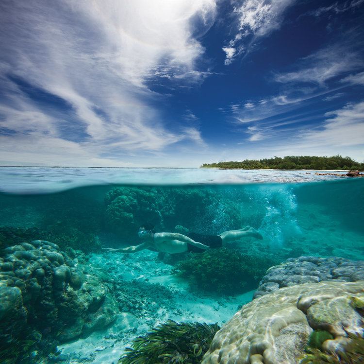
It is located 227 km southwest of Victoria, Seychelles. It is 5.5 km long and has a land area of 4.027 km2. Along its circumference of 13 km is a beach of fine sand. Conservation on the island is managed by Island Conservation Society.
Seychelles desroches island unravel travel tv
History
Desroches was named by Chevalier de Roslan, commander of the French corvette Heure du Berger, after the Chevalier des Roches,the Governor of Île de France (now Mauritius) and Île Bourbon (now Réunion) from 1767 to 1772. It was explored by the Chevalier de la Billioère in 1771. The British had originally named it Wood Island because of its dense tree vegetation. The island was an important producer of copra. in 1835 the first settlement was established Along with the remaining Amirante Islands, Desroches had been a part of the Seychelles since it became a separate colony in 1909. On November 8, 1965, the United Kingdom split Desroches from the Seychelles to become part of the newly created British Indian Ocean Territory together with Farquhar, Aldabra and the Chagos Archipelago, but returned it to the Seychelles with the first two. The purpose was to allow the construction of a military base for the mutual benefit of the United Kingdom and the United States. On June 23, 1976, Desroches was returned to Seychelles as a result of it attaining independence. on 1972, a tourist lodge was built on the island, on Lodge Beach. on 1988, the Lodge changed hands to MK resorts which renovated it to a Luxury resort with 20 rooms. on 2005, the resort was sold to Collins Properties which renovated it and added a spa in 2008 The island management was transferred to The Desroches Foundation, which developed tourist activities on the island, in a sustainable manner with environmental care. The Foundation have built a small guesthouse on the village The Foundation allowed expansion of the LUX hotel for free in return of building a new Conservation center and a tortoise restoration place on the island. the LUX managed resort was expanded to 60 rooms in 2008 in 2016 the resort was sold to Four Seasons hotels. Four Seasons are adding more rooms in Lodge beach, but the Madame Zabre Beach units are sold as residential buildings, and a new neighborhood will be formed in this area by 2017
Geography
It is located 36 km (22 mi) east of the Amirantes Bank, and separated from it by water over 1,300 metres (4,265 ft) deep. It lies on the southern edge of a reef of atoll character. At the northern edge of the atoll are the Shark Rocks, with least depths between 3 to 6 m (10 to 20 ft). The island is fringed by a drying reef which extends 1.6 km (1.0 mi) offshore from the northeastern extremity and 0.8 km (0.5 mi) from the southwestern extremity. The island is low and is covered with coconut palms and tall hardwood trees. A deep channel, about 1.6 km (1.0 mi) wide, leads into the lagoon. The least depth in the channel is 18.3 m (60 ft), and it crosses the atoll in a position about 11 km (7 mi) northwest of Desroches.
Demographics
Desroches has a population of a 100. about 60 are in the Collins group construction camp located at Madame Zabre Beach, 30 live in the Desroches settlement in the middle of the northwestern shore (looking to the lagoon),and 10 live in Lodge beach at the Hotel staff house. The Collins group Hotel will have 30 rooms in the south (former location of Desroches Island Resort), built in 1988, and 1 presidential villa at Madame Zabre Beach There is a lighthouse on the northeast end (Helene point) of the Desroches Island.
Administration
The island belongs to Outer Islands District. Being an island with a small population, there are not any government buildings or services. For many services, people have to go to Victoria, which is a difficult task.
Transport
The island is bisected by a 1,372 metres (4,501 ft) long paved airstrip in the southern part (IATA code DES, ICAO code FSDA). The island has regular service aircraft from Mahé.
Economics
The inhabitants on the island are engaged mainly in tourism, and in very small scale farming and fishing which are mainly for the island consumption.
Flora and Fauna
In 2007, Island Conservation Society opened a conservation center on the island, employing full-time staff. There are no endemic land birds, only introduced species. Around the hotel and village there are populations of house sparrows and zebra doves and in the woods Madagascar fodies and the more retiring grey francolin. Much of the island is covered in coconut trees but well-wooded pockets of forest remain. The long, encircling beach and beach-crest of Desroches are of national importance for both green turtle and hawksbill turtle, particularly on the south and northeast coasts. The only known endemic of the Amirantes, a species of cockroach Delosia ornata, is found here.
Small numbers of wedge-tailed shearwaters breed despite the presence of rats.