
Topo map USGS Deseret Peak West Prominence 1,771 m | Elevation 3,363 m | |
 | ||
Listing US most prominent peaks 74thUtah county high points 17th Similar Mount Ellen, Mount Peale, Delano Peak, Mount Nebo, Bald Mountain | ||
Backpacking deseret peak
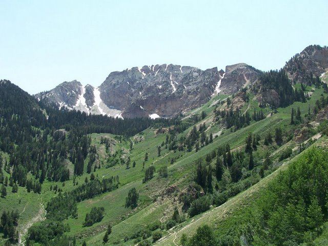
Deseret Peak is the highest peak in the Stansbury Mountains. It is located in the Deseret Peak Wilderness area west of Grantsville, Utah and east of Skull Valley Indian Reservation. The site is a popular destination for hikers as the area is a contrast of the alpine wilderness with the surrounding desert basin. The trail that leads to the peak is easily accessible from Salt Lake City. The mountain offers views of the Bonneville Salt Flats, the Great Salt Lake, and the surrounding towns and mountain ranges. On a clear day, it is possible to see Mount Nebo, the highest peak in the adjacent Wasatch Mountains.
Contents
- Backpacking deseret peak
- Map of Deseret Peak Utah 84022 USA
- Deseret peak motocross
- AccessEdit
- References
Map of Deseret Peak, Utah 84022, USA
Deseret peak motocross
AccessEdit
From Salt Lake City:
- Take Interstate 80 west from the city to Exit 88 (Grantsville)
- Take Burmeister Road south from Exit 88 to Grantsville's Main Street (Utah State Route 138)
- Take Grantsville Main Street west to 200 West, also known as "West Street"
- Take West Street south - it will turn south-southwest at the south edge of Grantsville, thereafter being known locally as "Mormon Trail Road"
- Follow Mormon Trail Road southwest to South Willow Canyon Road
- Take South Willow Canyon Road west to its upper terminus near the top of South Willow Canyon, where parking is available.
From the parking area, a 4-mile trail is well-marked to the summit.
References
Deseret Peak Wikipedia(Text) CC BY-SA