
Time zone EET (UTC+2) Licence plate 28 Elevation 346 m Local time Tuesday 6:41 AM | Region Black Sea Postal code 28950 Climate Cfb Area 830 km² Area code 0454 | |
 | ||
Weather 12°C, Wind E at 3 km/h, 28% Humidity | ||
Dereli is a town and district of Giresun Province in the Black Sea region of Turkey. The mayor is Kazım Zeki Şenlikoğlu (AKP).
Contents
Map of Dereli, 28950 Dereli%2FGiresun, Turkey
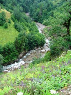
Dereli is a small town of 6,043 people in attractive countryside, in the valley of the Aksu Deresi and Akkaya River, inland 28 from Giresun on the road to Şebinkarahisar.
History
See Giresun for the history of this area, once occupied by the Hittites, Persians, Ancient Greek colonists from Miletos, Macedonians, Ancient Romans, Byzantines, Seljuk Turks, who settled in these valleys and arounds Muslim Kızılbaş, Turkmen Turks (Chepni) and finally the Ottoman Empire.
Places to see
References
Dereli Wikipedia(Text) CC BY-SA