
Local time Monday 1:50 PM | Time zone CET (UTC+1) | |
 | ||
Weather 8°C, Wind NE at 8 km/h, 82% Humidity | ||
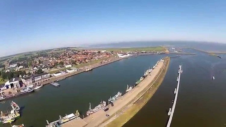
Den oever
Den Oever ( [dɛn ˈuvər]; in English, the shore, the coast) is a village in the Dutch province of North Holland. It is a part of the municipality of Hollands Kroon, and lies about 18 kilometres (11 mi) east of Den Helder.
Contents
Map of Den Oever, Netherlands
Overview
The village is located at the west side of the Afsluitdijk: therefore the Stevin lock (named after mathematician and engineer Simon Stevin) and three series of five sluices for discharging the IJsselmeer into the Wadden Sea were constructed in Den Oever.
In 2001, the town of Den Oever had 2286 inhabitants. The built-up area of the town was 0.53 km², and contained 938 residences.
The eightsided wooden grain smock mill "De Hoop" ("The Hope") is situated in the middle of the village with a wingspan of 17 metres (56 ft). It dates back into the 17th century (1654) and has been completely restored in the second half of the 20th century (1960, e.g. iron wingstocks, metal cap rolls for the wheeling or winding (cap rotating) mechanism from a Gelderland mill, new cast-iron windshaft etc.). Unusual with the mill is that it never has had a hoist mechanism.