
Existed: 1984 – present Length 91.81 km | Constructed 1984 | |
 | ||
Touristroutes: Harriet Tubman Underground Railroad Byway Counties | ||
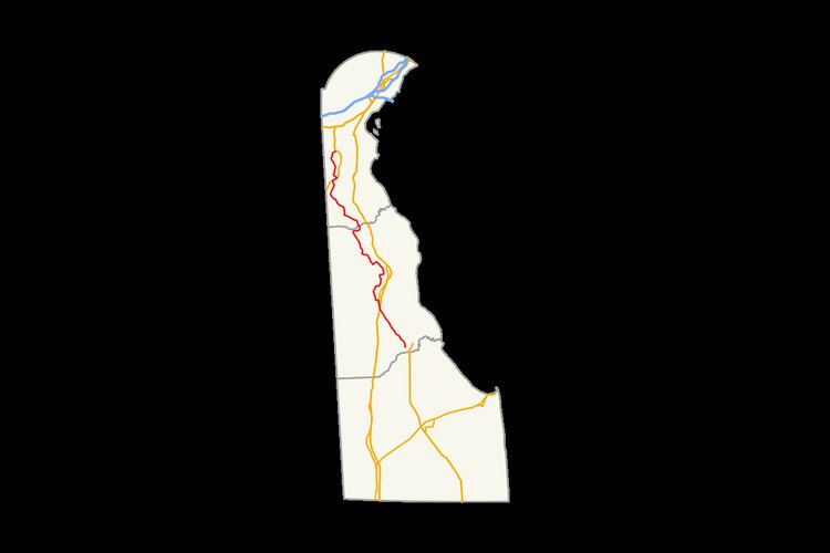
Delaware Route 15 (DE 15) is a state highway in the U.S. state of Delaware. The route runs from DE 14 west of Milford in Kent County to U.S. Route 301 (US 301)/DE 71/DE 896 in Summit Bridge, New Castle County, just south of Summit Bridge over the Chesapeake and Delaware Canal. DE 15 winds a path through many rural sections of Delaware, turning along many different roads. Most of the route, with the exception of the southern part of the route from Canterbury to Milford, runs to the west of US 13. DE 15 runs through the western outskirts of several cities and towns, including Wyoming, Dover, Clayton, and Middletown. The route intersects DE 12 near Felton, US 13 in Canterbury, DE 10 near Camden, DE 8 in Dover, DE 42 in Seven Hickories, DE 300 and DE 6 in the Clayton area, US 301/DE 299 in Middletown, and DE 286 near Summit Bridge.
Contents
Map of DE-15, Delaware, USA
What is now DE 15 was paved in several stages from the 1930s to the 1960s. By the 1980s, the route was designated between DE 14 in Milford and US 13 in Canterbury. By 1990, it was extended north to US 301/DE 299 near Middletown and then to US 301/DE 71/DE 896 near the Summit Bridge by 1994.
Kent County
DE 15 begins at an intersection with DE 14 west of the city of Milford in Kent County and proceeds northwest on two-lane undivided Canterbury Road. The road heads through a mix of farmland and woodland with some homes, crossing Browns Branch to the east of McColley Pond and the Murderkill River to the east of Coursey Pond. The route intersects DE 12 and runs to the east of Henderson Aviation Airport. DE 15 reaches the community of Canterbury, where it passes homes and comes to an intersection with US 13.
DE 15 turns north to form a concurrency with US 13 for a short distance on the four-lane divided Dupont Highway before continuing northwest along with US 13 Alt. on two-lane undivided Upper King Road. The road continues through rural land before entering Woodside. Here, US 13 Alt./DE 15 passes homes and intersects DE 10 Alt., with DE 15 splitting from US 13 Alt. by heading west along with DE 10 Alt. on Main Street and crossing Norfolk Southern's Delmarva Secondary railroad line.
DE 15 splits from DE 10 Alt. by turning north on Dundee Road, leaving Woodside. The road heads through a mix of farmland, woodland, and residential subdivisions, coming to an intersection with DE 10. Past this intersection, the route becomes Moose Lodge Road and continues north. DE 15 turns east onto Westville Road and enters Wyoming, where it becomes Southern Boulevard and passes homes and some businesses. The route turns northeast onto South Railroad Avenue and runs immediately to the west of the Norfolk Southern railroad line. The road becomes North Railroad Avenue before it leaves Wyoming as it passes to the east of Wyoming Lake. At this point, DE 15 becomes Wyoming Mill Road and heads north through agricultural areas away from the railroad tracks. The road continues through farmland with some woods and residential development before entering Dover and curving to the northwest.
Here, DE 15 turns east onto Hazlettville Road and heads into industrial areas, where it becomes West North Street and widens into a four-lane road. The route turns north onto two-lane Saulsbury Road, continuing through more commercial areas and coming to an intersection with DE 8. Past this intersection, DE 15 continues north as a three-lane road with a center left-turn lane, coming to a junction with Walker Road. Past this intersection, the road name changes to McKee Road and it runs northwest through residential areas with some fields and commercial development. The route loses the center left-turn lane past the College Road intersection. DE 15 turns west to remain on two-lane undivided McKee Road, with Scarborough Road continuing north to US 13 and DE 1. Past Scarborough Road, the route heads northwest near an industrial park before it leaves Dover.
Upon leaving Dover, DE 15 continues through a mix of farmland and woodland with some residential areas, turning southwest onto West Denneys Road and then north onto Kenton Road. The road curves to the north-northwest and reaches an intersection with DE 42 in Moores Corner. At this point, DE 15 turns west to form a concurrency with DE 42 on Seven Hickories Road. In Seven Hickories, DE 15 splits from DE 42 by heading north on Brenford Road. The route splits from Brenford Road and continues northwest on Mount Friendship Road, crossing the Leipsic River before reaching an intersection with DE 300. Here, DE 15 turns northeast for a brief concurrency with DE 300 on Wheatleys Pond Road before turning northwest on Alley Corner Road. The road crosses an abandoned railroad line before it comes to an intersection with DE 6. At this point, DE 15 turns east to form a concurrency with DE 6 on Millington Road. On the western edge of Clayton, DE 15 splits from DE 6 by heading northeast on Duck Creek Road, passing through residential areas with some industry. The road curves to the north and leaves Clayton.
New Castle County
DE 15 crosses the Duck Creek into New Castle County and the name becomes Clayton Greenspring Road as it passes through farm fields and woods with some homes. The route turns west onto Vandyke Greenspring Road and skirts the southern edge of the Blackbird State Forest, curving to the west-northwest and crossing Blackbird Creek. DE 15 turns north onto Dexter Corner Road before it continues west onto Blackbird Station Road, curving to the northwest. DE 15 crosses the Maryland and Delaware Railroad's Northern Line before turning north onto Dogtown Road and heading northwest again. The route runs through agricultural areas, crossing the Appoquinimink River, and turns north-northeast onto Levels Road. DE 15 passes to the west of a residential neighborhood before turning northwest at a roundabout to remain on Levels Road and reach an intersection with US 301/DE 299.
At this point, DE 15 turns northeast to join US 301/DE 299 on four-lane divided Middletown Warwick Road, entering commercial areas in the town of Middletown. At an intersection, the three routes split, with DE 15 heading northwest on Bunker Hill Road, DE 299 turning east onto Main Street, and US 301 continuing north along Middletown Warwick Road. Past US 301/DE 299, DE 15 becomes a two-lane undivided road, passing areas of homes and businesses and heading northeast of Appoquinimink High School. At a roundabout, the route turns north onto Choptank Road and leaves Middletown, heading through agricultural areas with some woods and residential development. DE 15 intersects the eastern terminus of DE 286 at a roundabout and continues northeast along Bethel Church Road, ending at an intersection with US 301/DE 71/DE 896 in Summit Bridge, just south of the Summit Bridge over the Chesapeake and Delaware Canal.
The portion of the route along the DE 6 concurrency west of Clayton and between Alley Mill Road and Caldwell Corner Road in southwestern New Castle County is part of the Harriet Tubman Underground Railroad Byway, a Delaware Byway. DE 15 has an annual average daily traffic count ranging from a high of 23,156 vehicles at the Walker Road intersection in Dover to a low of 504 vehicles along Duck Creek Road in Clayton. The portions of DE 15 concurrent with US 13, between DE 8 and Scarborough Road, and along the US 301/DE 299 concurrency are part of the National Highway System.
History
By 1920, the roads that comprise present-day DE 15 existed as county roads. Bunker Hill Road was paved by 1932, with Levels Road being constructed as a state highway by this time. Four years later, the segment between DE 12 and US 13, Brenford Road, a portion north of DE 6, and Bethel Church Road were paved, while Kenton Road was paved three years later. Paving was completed on the sections between DE 14 and Carpenters Bridge Road and from DE 8 to Kenton Road by 1942, and the entire segment between Clayton and Middletown excluding a portion of Blackbird Station Road. The remainder of the road between Milford and Canterbury, the portion between Woodside and DE 10, the portion between Wyoming and Dover, and the segment of Choptank Road between Bohemia Church Road and Bethel Church Road were all paved by 1952. The remainder of the route between Clayton and Middletown was paved two years later. By 1957, paving was completed on the remainder of Choptank Road. The section between Woodside and Wyoming was fully paved by 1959. The Mt. Friendship Road part of the current route was paved by 1964. Two years later, the paving of present-day DE 15 was completed when Alley Corner Road was paved.
DE 15 was designated to run from DE 14 near Milford north to US 13 in Canterbury by 1984. The route was extended north to US 301/DE 299 west of Middletown by 1990. Four years later, DE 15 was extended farther north to US 301/DE 71/DE 896 near the Summit Bridge. In 2011, Wyoming Mill Road was realigned to intersect Hazlettville Road further to the west at a signalized intersection, reducing congestion.