
District North Area 4.8 km² | Time zone IST (UTC+2) Local time Sunday 11:02 PM | |
 | ||
Weather 12°C, Wind NE at 8 km/h, 60% Humidity | ||
Deir al-Asad (Hebrew: דֵיר אֶל-אַסַד; Arabic: دير الأسد) is an Arab town in the Galilee region of Israel, near Karmiel. In 2003, the municipality of Deir al-Asad merged with Majd al-Krum and Bi'ina to form the city of Shaghur. However, it was reinstated in 2008 after Shaghur was dissolved. In 2015 it had a population of 11,716.
Contents
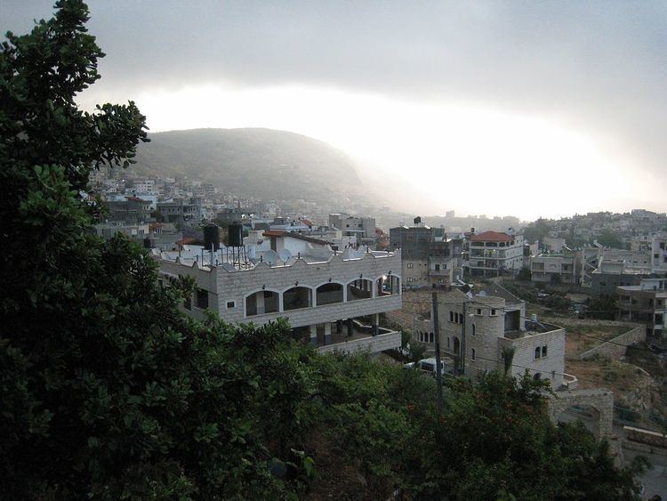
- Map of Deir al Asad Israel
- Etymology
- History
- Ottoman era
- British Mandate era
- 1948 and aftermath
- Crusader abbey and church remains
- Mosque and tomb of al Assad al Safadi
- Notable residents
- References
Map of Deir al-Asad, Israel
Etymology
Deir al-Asad means "the lion's monastery" in Arabic. The village was named after a leader
History
In the Crusader era, the site was a Christian settlement, La Bana, with a monastery named for St. George nearby. Upon arrival of the Ottoman Turks, the Christians were expelled by Sultan Suleiman I and their descendants later founded the nearby settlement of Bi'ina. The lands of the original Christian settlement and the monastery were given by the Sultan to the sheikh Al-Asad A-Zaffah from Safed and the latter founded the current village.
Ottoman era
Deir al-Asad and nearby Bi'ina were both inhabited by members of the Druze community when Victor Guérin visited in the 1875, but by the late 1870s, they had emigrated to the Hauran to avoid conscription by the Ottoman army. In the Palestine Exploration Fund's Survey of Western Palestine (SWP) in 1881, Deir al-Asad was described as a village of 600 Muslims, containing a few ruins of the original Christian settlement. It was surrounded by olive-trees and arable land, with a spring nearby.
British Mandate era
In the 1922 census of Palestine, conducted by the British Mandate authorities, Dair al-Asad had a population of 749, all Muslim, increasing in the 1931 census to 858, still all Muslims, living in total of 179 houses.
By 1945, Deir el Asad had 1,100 inhabitants, all Muslims. They owned a total of 8,366 dunams of land, while 7 dunams were public. 1,322 dunams were plantations and irrigable land, 1,340 used for cereals, while 38 dunams were built-up (urban) land.
1948, and aftermath
The town is mostly populated by the Asadi, Dabbah and Musa families.
Before 1962 the village of Deir al-Asad was self-sufficient in food. It produced enough meat, fruit, wheat and vegetables for itself and sold the surplus in Acre or Nazareth. In 1962 its land in the Majd al-Kurum valley was confiscated for the Karmiel town project, and the village was thereby stripped of its most fertile acres. Only the hill land to the north, consisting mainly of olive groves, remained. This confiscation of land ruined the economy of Deir al-Asad. Today only 10% of the labour force can work on the land, over 80% have to commute daily to the factories of Haifa or work as labourers on Jewish farms.
Crusader abbey and church remains
The large remains of a Crusader times church and abbey was already noted by Guérin and the "Survey of Western Palestine". Guérin noted after his 1875 visit that: 'Constructed of small stones very regularly cut, this church had three naves and three apses. Its windows were narrow, and fashioned like actual loopholes, and several details of its architecture show a knowledge of art. Unfortunately the Druses have half demolished it, and what they have spared has been converted into a stable.' Denys Pringle named it "The abbey Church of St. George," and dated it do the 12th century.
Mosque and tomb of al-Assad al-Safadi
The mosque and tomb of al-Assad al-Safadi is a two-domed structure, situated about 50 meters south of the Crusader abbey and church remains. Al-Muhibbi, a biographer writing in 1569, told that al-Assad was a Sufi sage, who was settled in the village with his children and followers after Ottoman sultan Suleiman the Magnificent had driven the Christians out. The smaller chamber, to the north, holds the tomb of al-Assad al-Safadi, while the southern, larger chamber holds a prayer hall. To the east there is a courtyard.