
Population 338 (2011 census) Local time Monday 3:11 AM | Postcode(s) 4621 Postal code 4621 | |
 | ||
Weather 23°C, Wind SW at 5 km/h, 87% Humidity | ||
Degilbo is a town in North Burnett Region, Queensland, Australia. At the 2011 census, Degilbo had a population of 338.
Contents
Map of Degilbo QLD 4621, Australia
History
The name Degilbo was the name of a pastoral run owned by William Henry Walsh (a Member of the Queensland Legislative Council) in 1847. It is believed to be an Aboriginal word dackeel bo meaning sharp or upright stones. A very popular story is that Degiblo is actually the word obliged spelt backwards, attributed to a railway surveyor, who had to assign names to many railway stations, had run out of ideas but as he was obliged to come up with a name, he wrote that word down backwards. Being perhaps a more entertaining story, the story of the backwards spelling is frequently published, and is usually followed by a spate of correspondence pointing out that the name of the pastoral run preceded the railway station by at least 20 years.
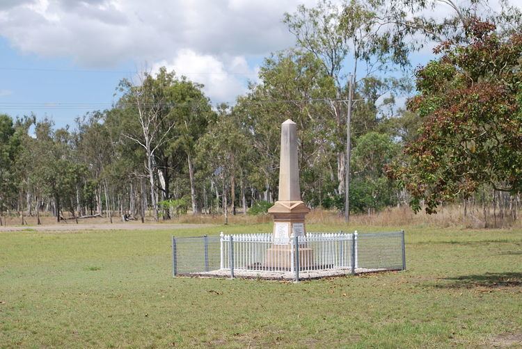
The Degilbo War Memorial commemorates those who served and died in World War I. It is located beside the Isis Highway.
The first Degilbo Post Office opened on 1 April 1893. It was renamed Woowoonga in 1894, Appallan in 1897 and Degilbo in 1898. It closed in 1958.
Heritage listings
Degilbo has a number of heritage-listed sites, including: