
Country United States County Santa Cruz FIPS code 06-18153 Elevation 401 m Zip code 95003 Area code 831 | Time zone PST (UTC-8) GNIS feature ID 1867010 Area 48.71 km² Population 3,409 (2010) | |
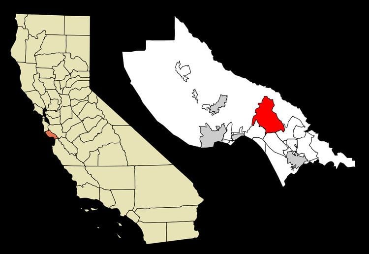 | ||
Day Valley is a census-designated place (CDP) in Santa Cruz County, California, United States. The population was 3,409 at the 2010 census.
Contents
Map of Day Valley, CA, USA
Geography
Day Valley is located at 37°0′32″N 121°51′24″W (37.008820, -121.856544).
According to the United States Census Bureau, the CDP has a total area of 18.8 square miles (49 km2), most of which is forest and meadows, with a creek at the crossroads of Valencia Rd. and Day Valley Rd.
2010
The 2010 United States Census reported that Day Valley had a population of 3,409. The population density was 181.3 people per square mile (70.0/km²). The racial makeup of Day Valley was 2,898 (85.0%) White, 20 (0.6%) African American, 23 (0.7%) Native American, 85 (2.5%) Asian, 4 (0.1%) Pacific Islander, 208 (6.1%) from other races, and 171 (5.0%) from two or more races. Hispanic or Latino of any race were 470 persons (13.8%).
The Census reported that 3,387 people (99.4% of the population) lived in households, 17 (0.5%) lived in non-institutionalized group quarters, and 5 (0.1%) were institutionalized.
There were 1,280 households, out of which 401 (31.3%) had children under the age of 18 living in them, 806 (63.0%) were opposite-sex married couples living together, 93 (7.3%) had a female householder with no husband present, 47 (3.7%) had a male householder with no wife present. There were 73 (5.7%) unmarried opposite-sex partnerships, and 14 (1.1%) same-sex married couples or partnerships. 236 households (18.4%) were made up of individuals and 93 (7.3%) had someone living alone who was 65 years of age or older. The average household size was 2.65. There were 946 families (73.9% of all households); the average family size was 2.99.
The population was spread out with 682 people (20.0%) under the age of 18, 261 people (7.7%) aged 18 to 24, 623 people (18.3%) aged 25 to 44, 1,285 people (37.7%) aged 45 to 64, and 558 people (16.4%) who were 65 years of age or older. The median age was 48.0 years. For every 100 females there were 101.0 males. For every 100 females age 18 and over, there were 99.3 males.
There were 1,366 housing units at an average density of 72.6 per square mile (28.0/km²), of which 1,007 (78.7%) were owner-occupied, and 273 (21.3%) were occupied by renters. The homeowner vacancy rate was 1.3%; the rental vacancy rate was 1.8%. 2,676 people (78.5% of the population) lived in owner-occupied housing units and 711 people (20.9%) lived in rental housing units.
2000
As of the census of 2000, there were 3,587 people, 1,283 households, and 946 families residing in the CDP. The population density was 188.7 people per square mile (72.9/km²). There were 1,346 housing units at an average density of 70.8 per square mile (27.3/km²). The racial makeup of the CDP was 86.37% White, 0.64% African American, 1.14% Native American, 1.67% Asian, 6.83% from other races, and 3.35% from two or more races. Hispanic or Latino of any race were 14.47% of the population.
There were 1,283 households out of which 35.6% had children under the age of 18 living with them, 63.4% were married couples living together, 6.4% had a female householder with no husband present, and 26.2% were non-families. 18.6% of all households were made up of individuals and 5.8% had someone living alone who was 65 years of age or older. The average household size was 2.78 and the average family size was 3.15.
In the CDP, the population was spread out with 25.5% under the age of 18, 6.3% from 18 to 24, 23.7% from 25 to 44, 33.5% from 45 to 64, and 11.0% who were 65 years of age or older. The median age was 42 years. For every 100 females there were 97.1 males. For every 100 females age 18 and over, there were 96.8 males.
The median income for a household in the CDP was $72,438, and the median income for a family was $78,310. Males had a median income of $61,615 versus $43,854 for females. The per capita income for the CDP was $31,694. About 2.0% of families and 5.4% of the population were below the poverty line, including 4.7% of those under age 18 and 3.9% of those age 65 or over.
Government
In the California State Legislature, Day Valley is in the 17th Senate District, represented by Democrat Bill Monning, and in the 29th Assembly District, represented by Democrat Mark Stone.
In the United States House of Representatives, Day Valley is in California's 20th congressional district, represented by Democrat Jimmy Panetta.
Local history
Many early settlers to Day Valley (including some members of the Day and Cox families) are buried in a small cemetery in the Forest and Meadows neighborhood, at the corner of Meadow Road and Downing Drive. Cox Road and Day Valley Road are named after these families.