
OS grid reference SE309099 Dialling code 01226 | Sovereign state United Kingdom Local time Friday 10:49 PM | |
 | ||
Population 21,345 (Wards. Darton East + Darton West. 2011) Weather 7°C, Wind SE at 6 km/h, 99% Humidity | ||
Darton is a large village in the Metropolitan Borough of Barnsley (part of South Yorkshire, England), on the border with West Yorkshire. At the time of the 2001 UK census, it had a population of 14,927, increasing to 21,345 for both Darton Wards (East & West) at the 2011 Census.
Contents
- Map of Darton UK
- Parliamentary representation
- Geography
- History
- Present day
- Education
- Sport
- Notable people
- References
Map of Darton, UK
Parliamentary representation
Formerly part of the now defunct Barnsley West and Penistone borough constituency, following the Boundary Commission for England's report on South Yorkshire's Parliamentary constituencies in 2004 and an inquiry in 2005, it is now part of the Barnsley Central borough constituency.
Geography
Darton lies on the River Dearne, directly to the east of Kexbrough, and 5 miles (8.0 km) north of the town of Barnsley. It is served by the A637 road and is bisected by the M1 motorway (junction 38 being a mile to the north). Its location is approximately 53°35′6″N 1°31′57″W, at an elevation of around 260 feet (79 m) above mean sea level.
History
The name Darton is believed to be an amalgamation of "Dearne" and the Anglo-Saxon word "ton" (meaning 'town'). Hence, in ancient times it was known as 'the town on the Dearne'. However, other sources dispute this explanation and claim that the name originates from a description given to a deer enclosure or something similar. In 1086 the hamlet of Dertone was in the wapentake of Staincross.
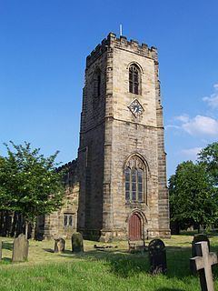
The hamlet grew to become a village so the Parish of Darton was founded in 1150, when the first church was built. As elsewhere in England, an official register of baptisms, deaths and marriages did not begin until later, in 1539. The parish was historically within the West Riding of Yorkshire and became a part of the modern county of South Yorkshire upon its creation in 1974.
Present day
Darton has its own railway station on Northern's Hallam Line which links train journeys between Sheffield and Leeds. The railway station is in South Yorkshire but West Yorkshire Metro tickets are also valid to and from this station. The reason for this is because the West-South Yorkshire boundary historically ran between the village and its main source of employment, Woolley Colliery.
On 15 June 2007, Darton hit the national headlines after 48 hours of torrential rain caused the River Dearne to burst its banks leading to heavy flooding in the village. The main road through the village was rendered impassable and many homes and businesses were damaged, including the village post office, which re-opened in June 2008. Further flooding occurred in January 2008, although the damage and disruption caused this time was not as bad as the previous year's.
Education
Darton has its own primary school and a secondary school called Darton College actually in Kexborough which opened in 2011.
Sport
Darton cricket club plays in the Pontefract and District Cricket League.