
OS grid reference NS528596 Sovereign state United Kingdom Postcode district G53 Dialling code 0141 | Post town GLASGOW | |
 | ||
Drone video dams to darnley in scotland
Darnley is an area in south-west Glasgow, Scotland located on the A727 just west of Arden (the areas are separated by the M77 motorway although a footbridge connects them). Other nearby districts are Priesthill to the north and Southpark Village and South Nitshill to the south. The closest railway station is Priesthill & Darnley.
Contents
- Drone video dams to darnley in scotland
- Map of Darnley Glasgow UK
- Dams to darnley country park 2016
- The Darnley plane tree
- Sainsburys
- References
Map of Darnley, Glasgow, UK
During the second half of the 20th Century Darnley experienced total transformation from being a modest semi-rural community to becoming a significant part of Glasgow's response to a post-war housing shortage. Following the construction of large housing schemes at South Nitshill (1957) and Kennishead (1966), in 1968 the City of Glasgow approved the building of 2,048 homes in Darnley. This scheme was to occupy an area to the north of Nitshill Road covered by Leggatston Farm, part of the original Darnley estate taken within the City of Glasgow boundaries in 1938.
Over three phases a total of 1,336 deck-access, two to seven storey apartment blocks were built. This fell short of the initial number planned owing to a combination of economic, political and management setbacks. It was intended that Darnley would be a largely self-supporting estate and for this reason two primary schools and a community centre formed part of the Council's plans. A social club and bowling green, a church, a small shopping centre and a library were all added throughout the 1970s.
The broadening of the A726 to dual carriageway status in 1983 heralded the development of the Nitshill corridor as a light industrial and retail location. Darnley Trading Estate and large retail outlets are clustered around junction 3 of the southward extension of the M77 motorway (completed in 1997). The closure of Darnley Hospital in 1992 and the opening on the site of a £3million 120-bed nursing home in 1993 has also altered the employment opportunities for the local population and has become symptomatic of the regeneration of modern Darnley. However, there is a huge retail area with large chain stores, including a Sainsbury's supermarket & petrol station, B&Q, Carphone Warehouse, McDonald's, Domino's Pizza, KFC, snack vans and smaller stores such as a Houlihans pharmacy and Shimla Village Indian takeaway.
Dams to darnley country park 2016
The Darnley plane tree
Queen Mary came to Glasgow early in 1567, having left Holyrood Palace in Edinburgh on 24 January to collect her husband, Lord Darnley. Darnley had reportedly contracted smallpox and the Queen intended to bring him back to Holyrood on a litter as he was too weak to ride a horse. Darnley returned with his wife, only to be murdered a few days later on 10 February.
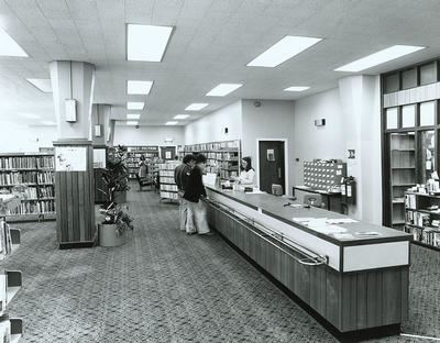
Sainsburys
Sainsburys on 7 February 2010, will have work on a £20million refit and extension programme started raising the store from 44,000sqft to 89,000sqft with a mezzanine floor being constructed at the Nitshill Road side of the store new petrol station and double deck car parking area.
The new petrol station opened on 20 August 2010, and is the first in the company to have green energy solutions like solar energy panels and rain water recycling for its car wash. The store will open at 9AM on 29 September 2010, and will be opened by all 17 of the long term employees who have been there since its initial opening in 1991. The store will become the Sainsbury's flagship store in Scotland again.