
Postcode(s) 4285 Darlington O'Reilly | Postal code 4285 | |
 | ||
Darlington is a locality in the Scenic Rim Region of South East Queensland, Australia.
Map of Darlington QLD 4285, Australia
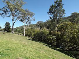
The locality occupies a section of the upper Albert River valley where the river branches in two. The lower elevations in the north of Darlingston are around 160 m above sea level with the highest ridges and peaks reaching 600 m. Mount Alexander rises in the north east where a series of ridges extend from the Lamington Plateau. Here the upper and steeper slopes remain vegetated. Large areas in the south were the terrain is less rugged have been cleared. In the west the high point along Jinbroken Range forms a border with Hillview and Christmas Creek.
The areas proximity to the Lamington National Park and a landscape typical of a Scenic Rim destination attracts tourists to the area. Darlington Park on Kerry Road is a privately run camping ground. Several other properties offer bed and breakfast, homestead and cottage accommodation.