
Population 463 (2011) Postcode(s) 4211 Lamington Southern Lamington Postal code 4211 | Established 1997 Founded 1997 | |
 | ||
Lamington is a rural locality in the Scenic Rim Region, Queensland, Australia. In the 2011 census, Lamington and surrounding localities had a population of 463 people.
Contents
Map of Lamington QLD 4285, Australia
Geography
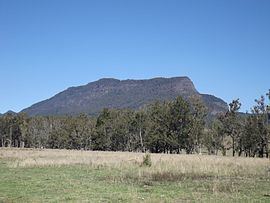
Christmas Creek is one of a number of tributaries of the Logan River which have headwaters in the McPherson Range along the border. The upper Christmas Creek valley is mountainous. Peaks at Lamington include Little Widgee Mountain, Bujera in the east while across the valley the slopes rise towards Neglected Mountain. The southern boundary follows a section of the western Lamington Plateau and Lamington National Park.
Railway
Lamington was the terminus for one branch of the Beaudesert Shire Tramway. It operated from 1910 to 1944.
References
Lamington, Queensland Wikipedia(Text) CC BY-SA