
Country United States Elevation 951 ft (290 m) Zip code 46122 Local time Friday 7:25 AM | Time zone EST (UTC-5) Population 9,424 (2013) | |
 | ||
Weather -4°C, Wind NW at 21 km/h, 63% Humidity | ||
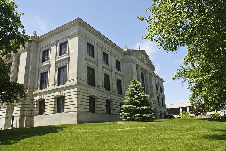
Town of danville indiana featured on today in america with terry bradshaw
Danville is a town in Center Township, Hendricks County, Indiana, United States. The population was 9,001 at the 2010 census. The town is the county seat of Hendricks County.
Contents
- Town of danville indiana featured on today in america with terry bradshaw
- Map of Danville IN 46122 USA
- Beautiful home for sale in danville indiana
- History
- Geography
- Airport
- 2010 census
- 2000 census
- Museums and other points of interest
- Education
- Notable people
- References
Map of Danville, IN 46122, USA
Beautiful home for sale in danville indiana
History
Danville was founded in 1824, and its post office one year later. Danville was incorporated as a town in 1835.
The Ora Adams House, Leander Campbell House, Danville Courthouse Square Historic District, Danville Main Street Historic District, Dr. Jeremiah and Ann Jane DePew House, Hendricks County Jail and Sheriff's Residence, Twin Bridges, and Wilson-Courtney House are listed on the National Register of Historic Places.
Geography
Danville is located at 39°45′39″N 86°31′4″W (39.760736, −86.517798).
According to the 2010 census, Danville has a total area of 6.98 square miles (18.08 km2), of which 6.93 square miles (17.95 km2) (or 99.28%) is land and 0.05 square miles (0.13 km2) (or 0.72%) is water.
Airport
2010 census
As of the census of 2010, there were 9,001 people, 3,344 households, and 2,398 families residing in the town. The population density was 1,298.8 inhabitants per square mile (501.5/km2). There were 3,589 housing units at an average density of 517.9 per square mile (200.0/km2). The racial makeup of the town was 96.8% White, 0.8% African American, 0.2% Native American, 0.4% Asian, 0.4% from other races, and 1.4% from two or more races. Hispanic or Latino of any race were 1.8% of the population.
There were 3,344 households of which 41.2% had children under the age of 18 living with them, 55.4% were married couples living together, 11.9% had a female householder with no husband present, 4.3% had a male householder with no wife present, and 28.3% were non-families. 23.0% of all households were made up of individuals and 10.1% had someone living alone who was 65 years of age or older. The average household size was 2.66 and the average family size was 3.14.
The median age in the town was 34.3 years. 29.3% of residents were under the age of 18; 7.6% were between the ages of 18 and 24; 28% were from 25 to 44; 23.3% were from 45 to 64; and 11.6% were 65 years of age or older. The gender makeup of the town was 48.5% male and 51.5% female.
2000 census
As of the census of 2000, there were 8,032 people, 2,350 households, and 1,670 families residing in the town. The population density was 1,047.7 people per square mile (404.2/km²). There were 2,506 housing units at an average density of 409.1 per square mile (157.8/km²). The racial makeup of the town was 98.38% White, 0.34% African American, 0.22% Native American, 0.26% Asian, 0.02% Pacific Islander, 0.11% from other races, and 0.67% from two or more races. Hispanic or Latino of any race were 1.06% of the population.
There were 2,350 households out of which 37.6% had children under the age of 18 living with them, 58.7% were married couples living together, 8.7% had a female householder with no husband present, and 28.9% were non-families. 25.1% of all households were made up of individuals and 12.5% had someone living alone who was 65 years of age or older. The average household size was 2.58 and the average family size was 3.11.
In the town, the population was spread out with 27.6% under the age of 18, 8.4% from 18 to 24, 30.3% from 25 to 44, 20.0% from 45 to 64, and 13.8% who were 65 years of age or older. The median age was 35 years. For every 100 females there were 98.3 males. For every 100 females age 18 and over, there were 95.0 males.
The median income for a household in the town was $54,330, and the median income for a family was $62,813. Males had a median income of $40,724 versus $26,678 for females. The per capita income for the town was $22,209. About 2.1% of families and 2.5% of the population were below the poverty line, including 1.3% of those under age 18 and 7.7% of those age 65 or over.
Museums and other points of interest
The Hendricks County Historical Museum is located in the former Sheriff's Residence and Jail at 170 South Washington in Danville. The building was erected in 1866 and served as the county jail until 1974. The two-story brick structure, listed on the National Register of Historic Places, is the only surviving example of the Second Empire style of architecture in the county. This style was popular after the American Civil War and has as defining elements a central tower and mansard roof. The Museum's collection includes items relating to domestic life, agriculture, military history, education and other aspects of our county's heritage. It also includes items relating to the history of Indiana Central Normal College (later Canterbury College), which was located in Danville from 1878 until 1951.
Education
Danville Community School Corporation, the school district which serves Danville, operates Danville Community High School, a secondary school (grades 9 through 12) located just off of U.S. Route 36. The mascot of Danville Community Schools is a Warrior in American Indian clothing. The school colors are crimson and gray. Other facilities operated by the school corporation are