
Topo map USGS Lonaconing Elevation 882 m | Easiest route Drive up Prominence 276 m Parent range Allegheny Mountains | |
 | ||
Similar Evitts Mountain, Spruce Knob, Lambs Knoll, Sugarloaf Mountain, Mount Davis | ||
060614 dans mountain state park pool work
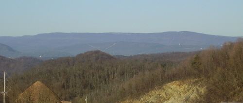
Dans Mountain is located in Allegany County, Maryland, USA between Georges Creek and the North Branch Potomac River. The highest point on Dans Mountain is called Dan's Rock which has an elevation of 2,895 feet (882 m). The mountain rises 2,200 feet (670 m) above the town of LaVale and the summit is the highest point in Allegany County. Although there are higher points in Maryland, Dans Mountain has the most impressive escarpment of Maryland's mountains. It is essentially continuous with the longer escarpment that continues both north (into Pennsylvania) and south (into West Virginia) known as the Allegheny Front.
Contents
- 060614 dans mountain state park pool work
- Map of Dans Mountain 7 Cresaptown2FBel Air MD 21557 USA
- Dans mountain maryland
- References
Map of Dans Mountain, 7, Cresaptown%2FBel Air, MD 21557, USA
Dans Mountain State Park is located along a 16-mile (26 km) stretch of the mountain, 9 miles (14 km) south of Frostburg, Maryland. Dan's Rock Overlook is the highest scenic overlook in the park. The park also features a pond that is stocked annually, an Olympic-sized pool with a modern bathhouse, and concession stands.
Dans Mountain is named for Daniel Cresap, one of the first settlers in Allegany County. Cresap was known for being adventurous, often hunting with a Delaware Indian named Nemacolin. While pursuing a bear in a tree, Daniel fell and lay unconscious until Nemacolin found him, and dragged Daniel home to safety. Since that event, the mountain has been known as Dans Mountain.
Dan's Mountain Wildlife Management Area protects the mountain in an area covering 9,504 acres.