
Barangay ZIP code 6013 Local time Thursday 12:05 AM | Time zone PST (UTC+8) Area 92.27 km² Province Cebu | |
 | ||
Weather 27°C, Wind N at 18 km/h, 77% Humidity Neighborhoods Tapilon, Bakhawan, Maya, Tominjao, Bagay, Lanao, Bitoon, Malingin, Logon, Pajo, Calape Points of interest Malapascua, Skip's Beach Resort, Virgin Beach Resort C, Guimbitayan, Blue Water Malapascua Beach an | ||
Kandaya resort daanbantayan cebu philippines dji osmo 4k
Daanbantayan is a 1st municipal income class municipality in the province of Cebu, Philippines, the northern tip of Cebu island. According to the 2015 census, it has a population of 84,430. In the 2016 electoral roll, it had 48,601 registered voters.
Contents
- Kandaya resort daanbantayan cebu philippines dji osmo 4k
- Map of Daanbantayan Cebu Philippines
- History
- Islands and thalassic attractions
- Barangays
- Demographics
- Transportation
- Tourism
- References
Map of Daanbantayan, Cebu, Philippines
Daanbantayan celebrates its annual fiesta along with the Haladaya Festival which starts 21 August and ends with street-dancing on 30 August, in honor of Datu Daya, the legendary founder of the town.
History
The name Daanbantayan was derived from two words: the word "daan", which means "old" in Cebuano, and the word "bantayan", which refers to a place that served as a look out for Moro raiders during the Pre-Hispanic Philippines. Older usages have the two words separately, as "Daan Bantayan". The original site of the town might have been at an elevated vantage point near Punta, in Tapilon.
In 1945, the Philippine Commonwealth Army troops of the 3rd, 8th, 81st, 82nd, 83rd, 85th and 86th Infantry Division of the Philippine Army entered the town of Daanbantayan, supported by the Cebuano guerrillas, and were attacked by the Japanese forces in the Battle of Daanbantayan during World War II.
On 8 November 2013, 9 people were killed and 50 injured when Super Typhoon Haiyan (Yolanda in Philippines area of responsibility) passed over Daanbantayan.
Islands and thalassic attractions
There are several small islands / islets and diving spots some distance from Cebu island:
Barangays
Daanbantayan comprises 20 barangays:
Demographics
In the 2016 electoral roll, it had 48,601 registered voters, meaning that 58% of the population are aged 18 and over.
Transportation
Ceres Liner, Rough Riders and Cebu Autobus are among the bus companies with regular service to and from Cebu city (North Bus Terminal). Jeepneys, tricycles, and trisikads are the main modes of transportation within the town.
Tourism
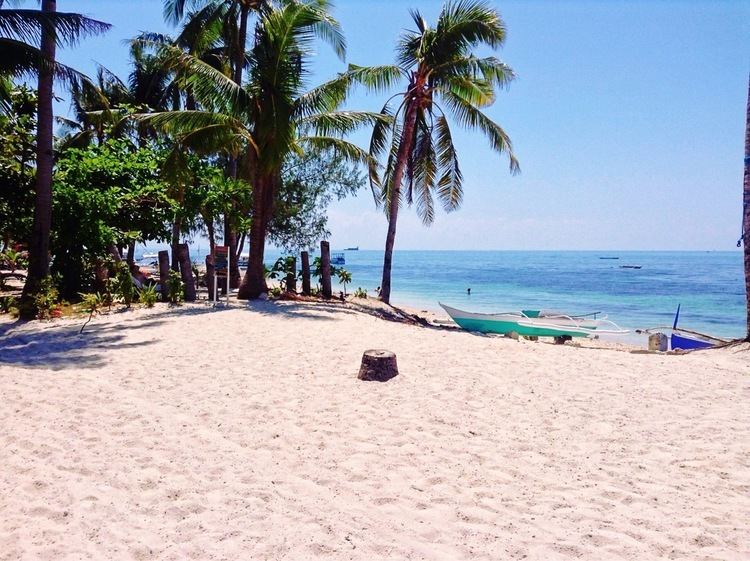
Daanbantayan is now known for its pristine, white powder-like sandy beaches – one of which is Malapascua Island. With its vast and rich marine resources, it hosts a long string of dive sites offering unique marine life and beauty.
As a tourist destination, Daanbantayan stages the Haladaya Festival every year as an added attraction to local vacationers, holidaymakers, Filipino expatriates, and foreign tourists from as far away as North America, South America, and Europe.