
Postal Code 537070 Area 61.73 km² Population 2,291 (2011) | Time zone EET (UTC+2) Area code(s) +40 234 Local time Thursday 12:27 AM | |
 | ||
Weather 1°C, Wind W at 6 km/h, 100% Humidity | ||
Dănești (Hungarian: Csíkdánfalva or colloquially Dánfalva, [ˈtʃiːkdaːnfɒlvɒ]) is a commune in Harghita County, Romania. It lies in the Székely Land, an ethno-cultural region in eastern Transylvania. The commune is composed of a single village, Dănești. It also included Mădăraș until 2002, when it was split off to form a separate commune.
Contents
- Map of DC483neC899ti 537070 Romania
- History
- Geography
- Demographics
- Landmarks
- Notable people
- Twinning
- References
Map of D%C4%83ne%C8%99ti 537070, Romania
History
It was first recorded in 1567 as Danffalwa and in 1576 as Dánfalva. Its name derives from the Hungarian and means 'Daniel's village' using the archaic Hungarian form of the name. Until 1919, its Romanian name used to be Danfalău, which was then Romanianized to the current official name.
Until 1779, villagers were engaged in the operation of iron hammers, but in the 19th century it became a potters' village. Today, it has a black pottery factory. The village provided servicemen for the 7th Company of 1st Székely Infantry Regiment until 1851. Wood processing, animal-breeding and transportation were the main preoccupation of the villagers.
The village administratively belonged to Csíkszék district in the Kingdom of Hungary until the administrative reform of Transylvania in 1876, when it fell within Csík County. After the Treaty of Trianon of 1920, the village, like the rest of Tranylvania, became part of Romania and fell within Ciuc County during the interwar period. In 1940, the second Vienna Award granted Northern Transylvania to Hungary and the village was held by Hungary until 1944. After Soviet occupation, the Romanian administration returned and the village became officially part of Romania in 1947. Between 1952 and 1960, the village fell within the Magyar Autonomous Region, between 1960 and 1968 the Mureș-Magyar Autonomous Region. In 1968, the province was abolished, and since then, the commune has been part of Harghita County.
Geography
It is located 21 km north of the county seat where the Köd Brook enters the Olt River. The commune is cut by the road E 578 and a railway line. Its natural resources: iron ore, mercury, kaolin, cinnabar, mineral water.
Demographics
The commune has an absolute Hungarian (Székely) majority. According to the 2011 census it has a population of 2,291 of which 99.04% or 2,269 are Hungarian.
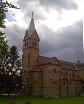
Landmarks
Notable people
The following notable people were born here:
Twinning
The commune is twinned with