
Country United States FIPS code 21-19432 Elevation 224 m Zip code 41031 Population 6,354 (2013) | Time zone EST (UTC-5) GNIS feature ID 0490519 Area 8.5 km² Local time Tuesday 8:31 AM Area code 859 | |
 | ||
Weather 13°C, Wind S at 29 km/h, 85% Humidity | ||
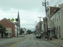
Cynthiana is a home rule-class city in Harrison County, Kentucky, in the United States. The population was 6,402 at the 2010 census. It is the seat of its county and is located roughly halfway between Cincinnati and Lexington.
Contents
- Map of Cynthiana KY 41031 USA
- History
- Geography
- US Highways
- Kentucky state highways
- Education
- Churches
- Demographics
- Notable natives and residents
- In popular culture
- Climate
- References
Map of Cynthiana, KY 41031, USA
History
Cynthiana was named after Cynthia and Anna Harrison, daughters of Robert Harrison, who had donated land for its establishment, though Harrison County was named after Colonel Benjamin Harrison, who was an early settler in the area and the sheriff of Bourbon County.
Two Civil War battles were fought in Cynthiana; the first on July 17, 1862, was part of a raid into Kentucky by Confederate General John Hunt Morgan; the second on June 11 and 12, 1864, resulted in defeat of Confederate forces on Morgan's last raid into the state.
On January 23, 1877, an LL chondrite meteorite fell in Cynthiana.
In March, 1997, the Licking River which bisects Cynthiana flooded, causing extensive damage in Cynthiana and neighboring communities.
Geography
Cynthiana is located at 38°23′18″N 84°17′49″W (38.388292, -84.296841).
According to the United States Census Bureau, the city has a total area of 3.3 square miles (8.5 km2), all land.
U.S. Highways
Kentucky state highways
Education
Cynthiana is served by the Harrison County School District with a total of 7 public schools located within the county limits:
Cynthiana has one private school:
Maysville Community and Technical College has an extended campus located in Cynthiana
Churches
Two historic churches are located in Cynthiana. The Indian Creek Baptist Church (originally the Endecott Meeting House), is located at historic highway marker 1457 at the junction of KY highways 32 and 36. Built in 1790, the church was in service until 1965. According to state marker, the cemetery contains the burial plots of early settlers including Reverend Charles Webb, Moses Endicott, Edward McShane, Henry Talbert and Hugh Wilson. The Indian Creek Christian Church was built in 1908. Later additions included an education wing (1971), fellowship hall (1986) and a Family Life Center (2005). The church claims itself the "oldest independent Christian Church of the American Restoration Movement."
Demographics
As of the census of 2000, there were 6,258 people, 2,692 households, and 1,639 families residing in the city. The population density was 1,873.6 people per square mile (723.4/km²). There were 2,909 housing units at an average density of 870.9 per square mile (336.3/km²). The racial makeup of the city was 92.43% White, 5.29% Black or African American, 0.16% Native American, 0.18% Asian, 0.05% Pacific Islander, 0.81% from other races, and 1.09% from two or more races. Hispanic or Latino of any race were 1.41% of the population.
There were 2,692 households out of which 27.3% had children under the age of 18 living with them, 42.2% were married couples living together, 14.9% had a female householder with no husband present, and 39.1% were non-families. 36.0% of all households were made up of individuals and 18.7% had someone living alone who was 65 years of age or older. The average household size was 2.24 and the average family size was 2.89.
In the city, the population was spread out with 22.7% under the age of 18, 9.0% from 18 to 24, 26.3% from 25 to 44, 21.9% from 45 to 64, and 20.1% who were 65 years of age or older. The median age was 40 years. For every 100 females there were 80.9 males. For every 100 females age 18 and over, there were 77.3 males.
The median income for a household in the city was $28,519, and the median income for a family was $34,691. Males had a median income of $27,704 versus $20,659 for females. The per capita income for the city was $15,227. About 13.3% of families and 16.1% of the population were below the poverty line, including 23.1% of those under age 18 and 11.7% of those age 65 or over.
Notable natives and residents
In popular culture
Climate
The climate in this area is characterized by hot, humid summers and generally mild to cool winters. According to the Köppen Climate Classification system, Cynthiana has a humid subtropical climate, abbreviated "Cfa" on climate maps.