
OS grid reference SN789740 Country Wales Postcode district SY23 Local time Tuesday 1:30 AM | Sovereign state United Kingdom Police Dyfed-Powys Dialling code 01974 Post town Aberystwyth | |
 | ||
Weather 4°C, Wind NW at 16 km/h, 78% Humidity | ||
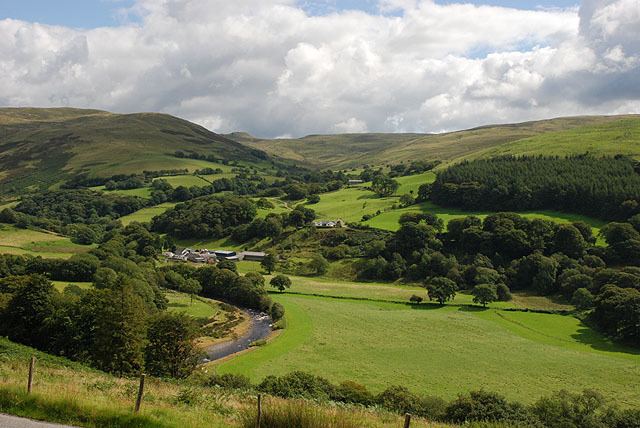
Cwmystwyth
Cwmystwyth (also Cwm Ystwyth; English: "valley of the River Ystwyth") is a village in Ceredigion, Wales near Devil's Bridge, and Pont-rhyd-y-groes.
Contents
Map of Cwmystwyth, Aberystwyth, UK
The Ordnance Survey calculates Cwmystwyth to be the centre point of Wales (52°19′48.791″N 3°45′59.072″W; grid reference SN7972871704).
History
See Cwmystwyth Mines
Discovery of small, oval-shaped stone tools in the area points to the fact that it has been mined for lead since the time of ancient Britons and during Roman occupation. Documentation of mining activities occurred during the reign of Elizabeth I. She engaged the services of two German miners, then went on to sub-let to Hugh Myddleton.
Community Archive Wales Project
Cofnodion Cwmystwyth is a recently established local history group based in Cwmystwyth. The group has 14 regular members of various ages drawn from the Communities First area of Tregaron Uplands, all with a passion for the history of the area. As well as including images, the archive includes transcriptions of census data, baptismal registers and log books as a means of interpreting the history of the village. In the long-term, it is hoped that the project will act as a springboard for establishment of a Cwmystwyth History Society which would produce materials relating to the area and eventually to the creation of a heritage centre to showcase the history of the village. Cofnodion Cwmystwyth joined the Community Archives Wales project in 2007.
Climate
Cwmystwyth experiences an oceanic climate (Köppen climate classification Cfb) similar to almost all of Wales and the United Kingdom. This translates to a narrow range of temperatures, rainfall in all seasons and low sunshine levels, particularly at upland locations such as inland Wales.
The MetOffice maintains a weather station in the village, with online climate records dating back to 1959. Temperatures range from an absolute high of 32.3 °C (90.1 °F) recorded during July 2006, down to an absolute low of −16.7 °C (1.9 °F), recorded during January 1963. During an 'average' year, the warmest day will likely reach 26.1 °C (79.0 °F) and the coldest night fall to −8.0 °C (17.6 °F). In total just over 3 days should record a temperature of 25.1 °C (77.2 °F) or above, and 59.3 nights should report an air frost.
Rainfall, as one might expect for an elevated place in Wales, is high, at nearly 2000mm a year. At least 1mm will be observed on over 189 days of the year, on average. All averages refer to the period 1971-2000.