
OS grid reference SN3436 Country Wales Post town LLANDYSUL Local time Tuesday 1:28 AM Dialling code 01559 | Sovereign state United Kingdom Postcode district SA44 5HT | |
 | ||
Weather 4°C, Wind W at 18 km/h, 84% Humidity Welsh assembly Carmarthen East and Dinefwr | ||
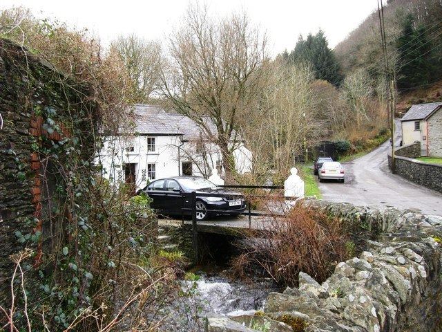
Cwmpengraig is a rural hamlet in Wales, located in the Teifi Valley approximately 1.5 miles (2.4 km) from the village of Drefach Velindre.
Contents
Map of Cwmpengraig, Llandysul, UK
Woollen mills & trails
Cwmpengraig is part of the Carmarthen Heritage Trails and also the Discover Carmathenshire ramblers trail for Drefach Velindre. Located just 1.5 miles from Drefach Velindre, Cwmpengraig is a small community with a history of woollen mill production. In the early 19th century, furling mills were established in Pentrecwrt, Dolwyon, Drefach and Cwmpengraig. By the beginning of the 20th century, substantial mills were built, employing 50-100 people. Mill cottages were built to house the employees although by the end of the 1920s the industry went into decline.
The Hamlet
Through the centre of the hamlet runs the stream Nant Esgair which flows down into the rural village of Drefach Velindre. At the centre of the hamlet is the handsome little Soar Chapel. A number of mill cottages still exist along the river valley.