
Airport type Public Elevation AMSL 1,827 ft / 556 m 17/35 4,605 Elevation 556 m Owner CITY OF BRADY | Website BradyCurtisField.com 4,605 1,404 Phone +1 325-597-1461 | |
 | ||
Address 3825 N Bridge St, Brady, TX 76825, USA | ||
Meet curtis fields and watch him perform using only his iphone
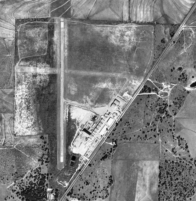
Curtis Field (IATA: BBD, ICAO: KBBD, FAA LID: BBD) is a city-owned airport three miles northeast of Brady, in McCulloch County, Texas. The FAA's National Plan of Integrated Airport Systems for 2009–2013 calls it a general aviation facility.
Contents
Curtis fields opposites attract lyric video
History
The airport opened in August 1941. On 1 January 1942, the facility was taken over by the United States Army Air Forces and was used during World War II as a primary (stage 1) pilot training airfield. Known as Curtis Field, the facility was operated as a contract pilot school, operated initially by the Brady Aviation School for the USAAF Gulf Coast Training Center (later Central Flying Training Command). Later, the contract was taken over by the Dallas Aviation School and Air College.
Several local axillary landing airfields were associated with Curtis Field, the Curtis Ranch; Moore Field; Sneed Field and White Field for emergency and overflow landings.
It is notable that enlisted sergeant pilots received their primary flight training at Curtis Field in early 1942. This program was ended later in the year. The last pilot training class ended in February 1945 and military control of the airport ended.
Airline flights (Trans-Texas DC-3s) ended in 1958-59.