
Established February 6, 1945 | Visitors 924,468 (in 2011) Phone +1 970-641-2337 Management National Park Service | |
 | ||
Area 43,095 acres (174.40 km) Website Curecanti National Recreation Area Address 102 Elk Creek, Gunnison, CO 81230, USA Hours Open today · 8AM–4PMMonday8AM–4PMTuesday8AM–4PMWednesday8AM–4PMThursday8AM–4PMFriday8AM–4PMSaturday8AM–4PMSunday8AM–4PM Similar Lake Fork Campgro, Blue Mesa RV Ranch, Elk Creek Marina, Soap Creek Corral / C, Gunnison Lakeside RV Park | ||
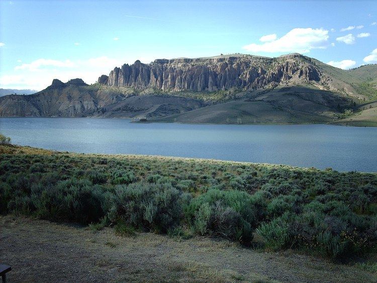
Curecanti national recreation area blue mesa the black canyon of the gunnison tour
Curecanti National Recreation Area, in Colorado, is formed by three reservoirs, named for corresponding dams on the Gunnison River. The national recreation area borders Black Canyon of the Gunnison National Park on the west. Panoramic mesas, fjord-like reservoirs, and deep, steep and narrow canyons abound.
Contents
- Curecanti national recreation area blue mesa the black canyon of the gunnison tour
- Curecanti national recreation area deep river and big fish
- Reservoirs and dams in Curecanti
- Visitor facilities
- Trails
- Other attractions
- References
Recently discovered dinosaur fossils, a 6,700-acre (20 km2) archeological district, a narrow gauge train, and traces of 6000-year-old dwellings further enhance the offerings of Curecanti.
Curecanti national recreation area deep river and big fish
Reservoirs and dams in Curecanti
Visitor facilities
There are three visitor centers within the recreation area, all operated by the National Park Service:
There are also two marinas and five boat launches along the shores of Blue Mesa Reservoir.
Trails
The Neversink trail is located nearest to Gunnison on the north bank of the Gunnison River near a Great Blue Heron rookery. This streamside habitat with its heavy undergrowth of grasses, flowers, cottonwoods, and willows, is ideal for birdwatching or just a quiet stroll.
Length: 1.5 miles (round trip) Difficulty: easy This trail is flat and provides easy walking. It is also wheel chair accessible. Directions: off Hwy 50, 5 miles (8.0 km) west of Gunnison
Ascending through sagebrush, ponderosa pine and riparian habitats, this trail offers spectacular views of Blue Mesa Reservoir, the distant San Juan Mountain peaks, and the weirdly eroded volcanic Dillon Pinnacles. Along the trail are a few shady places to rest and open sunny vistas with possible glimpses of bighorn sheep. Horses permitted. Interpretative signs explain geologic history. Benches are provided. Good shoes or boots are recommended. Carry at least 2 quarts of water per person.
Length: 4 miles (round trip) Difficulty: moderately strenuous; 600 ft (180 m) ascent. Directions: off Hwy 50, 6 miles (9.7 km) west of Elk Creek Visitor Center.
Follow the beautiful Pine Creek as it cascades into the depths of the upper Black Canyon to Morrow Point Reservoir. Then take a walk along the old narrow gauge railroad bed along the reservoir. Learn the history of the area by reading the interpretive signs on the trail. Be sure to check for ticks during the hot summer months. Fishing, camping, and boating access for Morrow Point Reservoir. No boat launching facilities. Small hand-carried craft are permitted if carried down the steps (and back up).
Length: 2 miles (round trip) Difficulty: Moderately strenuous. 180 ft (55 m). descent into the canyon via maintained steps. Carry at least one quart of water per person. Directions: Off Highway 50, one mile (1.6 km) west of its junction with Highway 92. A short steep road leads to the trail. Parking space is limited. Drop-off parking for trailers is available at the top of access road.
The sheer walls and extreme narrowness of the Black Canyon are appreciated along this trail as well as views from the base of the Morrow Point Dam. A footbridge over Crystal Reservoir provides access to the north shore of the reservoir, to which this trail follows. Fishing and boating access to Crystal Reservoir. No boat launching facilities. Small craft must hand launched. Caution: Releases from Morrow Point Dam can cause strong currents and fluctuating water levels. Walk in picnic area is located on the north shore.
Length: 1.5 miles (round trip) Difficulty: Easy to moderately strenuous. Directions: Off Highway 50, at Cimarron. Drive one mile (1.6 km) to Morrow Pont Dam parking area.
After descending from the high rim of the Upper Black Canyon of the Gunnison, the trail follows Curecanti Creek as it falls toward Morrow Point Reservoir. The Curecanti Needle, a 700 ft (210 m). granite spire, towers above at the trail's end. Good shoes or boots are recommended. Carry at least 2 quarts of water per person. Two campsites with picnic tables, fire grates, and toilets are provided at the end of the trail.
Length: 4 miles (round trip) Difficulty: Strenuous. Elevation change 900 ft (270 m). Allow 2–3 hours for round trip. Directions: The trail head begins at the Pioneer Point overlook, off Highway 92, 5.7 miles (9.2 km) from its junction with Highway 50.
Zigzagging through oak, pine, juniper, and fir, hikers descend to wooded camp and picnic sites on the shores of Morrow Point Reservoir. Campsites with picnic tables, fire grates, and toilets are provided at the end of the trail. Good shoes or boots are recommended. Carry at least 2 quarts of water per person. Check for ticks frequently during the hot summer months.
Length: 6 miles (round trip) Difficulty: Very strenuous and little shade. Elevation change is 1,800 ft (550 m). Allow 3 hours for round trip. Directions: off Highway 92, 17 miles (27 km) west from its junction with Highway 50
Winding through abundant wildflowers, Gambel oak, aspens, conifers and a recovering burn area, Crystal Creek Trail is ideal for spring or fall hiking. Sweeping views of Cimarron Valley, the West Elk and San Juan Mountains can be viewed along the way. The trail ends at an overlook, 1,800 ft (550 m). above Crystal Reservoir. Good shoes or boots are recommended. Carry at least 2 quarts of water per person. Check for ticks frequently during the hot summer months.
Length: 5 miles (round trip) Difficulty: Moderately strenuous. Trail begins at 8,900 ft (2,700 m) above sea level. Allow 2 hours for round trip. Directions: Off Highway 92, 24 miles (39 km) from its junction with Highway 50.