
Airport type Public 3/21 6,000 Elevation 1,206 m Phone +1 915-283-2059 | Elevation AMSL 3,957 ft / 1,206 m 6,000 1,829 Code VHN | |
 | ||
Similar Culberson County Dmv, Culberson County Appraisal, Culberson County Treasurer, Culberson County Auditor, Pilot Travel Center | ||
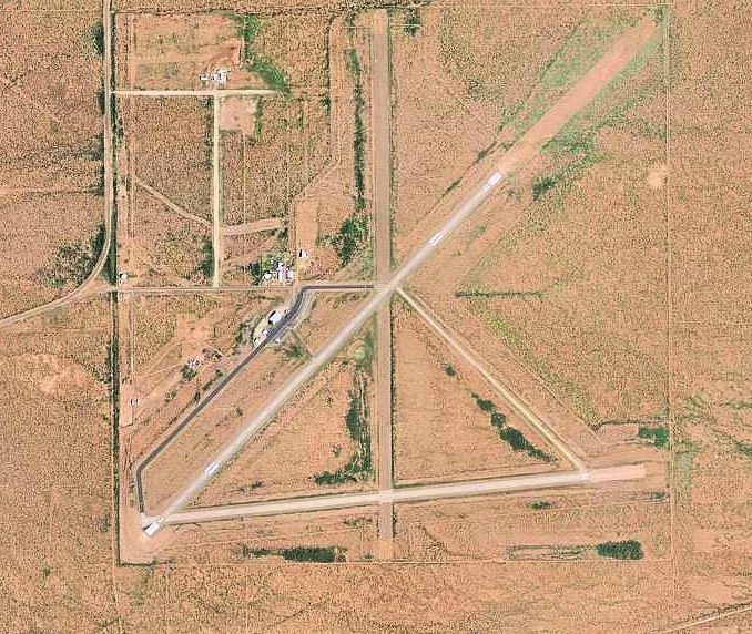
Culberson County Airport (IATA: VHN, ICAO: KVHN, FAA LID: VHN) is a county-owned public-use airport located three miles (5 km) northeast of the central business district of Van Horn, a town in Culberson County, Texas, United States.
Contents
Facilities and aircraft
Culberson County Airport covers an area of 1,000 acres (405 ha) which contains two asphalt paved runways: 3/21 measuring 6,000 x 75 ft. (1,829 x 23 m) and 7/25 measuring 5,353 x 75 ft. (1,632 x 23 m). For the 12-month period ending April 27, 2007, the airport had 500 aircraft operations: 60% general aviation and 40% military.
History
During World War II the airfield was used by the United States Army Air Forces
References
Culberson County Airport Wikipedia(Text) CC BY-SA